Knebworth Neighbourhood Plan 2019 - 2031
9 Policies - Environment and Flooding
9.1 Introduction
This section of the Neighbourhood Plan covers biodiversity, environmental pollution, energy conservation, flooding and drainage, important views and character areas, and heritage assets.
A set of policies have been written by the sub-group. As part of this process, each policy has been considered using many sources including central and local government, local knowledge and experience, environmental groups and industry standards.
The Objectives that were developed from the Knebworth Neighbourhood Plan Vision Statement and which led to the development of the Environment and Flooding Policies were:
G. Promote best practice in environmental performance of all construction projects to achieve low energy usage, incorporate renewable energy initiatives, conserve water, re-use building materials, provide electric car charging points and ensure all new buildings are carbon-neutral
H. Require all new development to be of high-quality design and contribute towards Knebworth's character by being sympathetic to design of surrounding areas
K. Seek cost effective and innovative solutions to minimise the amount of land taken up with car parking
L Retain the existing architectural character of the Garden Village, conservation areas and other heritage assets
M. Protect, enhance and increase accessibility to and the number of green spaces for recreational and health use
S. Provide guidance on eliminating air, light, soil, water and noise pollution
T. Lobby appropriate bodies to undertake required improvements to eliminate current flooding problems and ensure new development is designed to prevent future flooding issues
U. Protect key views and character areas from the negative impact of new development
V. Preserve existing and design integral wildlife corridors and habitats into new developments to improve biodiversity, reducing public lighting to the minimum needed to ensure residents' safety where light pollution impacts wildlife
9.2 Policy KBEF1 Biodiversity
KBEF1 Biodiversity
In order to ensure a net gain of biodiversity and improve biodiversity overall, all developments must:
- wherever possible, retain existing trees, hedgerows and green road borders to minimize disruption to wildlife;
- preserve existing and propose new wildlife corridors and habitats;
- reduce or eliminate gaps in existing corridors by diverse planting;
- create new corridors within developments to reduce built 'mass', enhance wildlife diversity and to increase surface water retention. Some should connect with new small wooded areas.
Additional guidance provided by Hertfordshire Ecology and Hertfordshire and Middlesex Wildlife Trust, including use of a biodiversity calculator should be taken into account when assessing the ecological merits of planning applications.
This policy applies to all major developments. A net gain in biodiversity will be mandatory, in the new Environment Bill. More detail on how DEFRA hope to achieve this can be found in their Biodiversity 2020 strategy (DEFRA, 2020). Smaller developments may provide an opportunity to enhance green infrastructure and Sustainable Urban Drainage Systems (SuDS) create drainage pathways which can also function as wildlife corridors. Without wildlife corridors, animals may find it difficult to maintain healthy populations. Essential to the wildlife corridors is a wide variety of both deciduous and evergreen trees and shrubs. Over time, these small changes can make a significant difference.
Herts Environmental Record Centre have identified the historical siting of over 1100 species of both flora and fauna, along with their type, rarity/extinction status within Hertfordshire (compiled for the KNPSC during the preparation of the Plan). Of these, the 50 extinct or believed extinct species are all invertebrates (moths, butterflies and dragonflies). Many may have specific habitats for their food or lifecycle, and this could indicate that the specific ecosystems for their survival have been lost. A recent report, the State of Nature (State of Natue Partnership, 2019) has highlighted just how many species are at risk. These include butterflies and moths, plants, vertebrates, invertebrates as well as fungi and lichen.
The land surrounding Knebworth House includes a range of nationally important and declining habitats, rare plants and its ancient woodland is a SSSI. Knebworth's rich natural heritage includes Knebworth Woods Site of Special Scientific Interest (SSSI), eight Ancient Woodlands and 20 Local Wildlife Sites, listed in Appendix H to the plan. Knebworth's rich biodiversity should be secured for future generations.
New developments should, wherever possible, retain existing trees, hedgerows and green road borders to minimise disruption to wildlife. Wherever possible means that removal of mature trees will need justification and access to the sites should be through natural breaks. Removal of hedgerows and verges for access should only be considered as a last resort. In addition, care must be taken to ensure that tree roots are not damaged as they may extend well past the crown of the tree itself.
Prior to developments, a green infrastructure audit should be carried out. This will help to provide a checklist for potential improvements and identify possible links to existing green infrastructure. Natural England has a biodiversity calculator (DEFRA, 2020) and this (or recognised developer-independent equivalent) should be used prior to any major development to ensure that there is a baseline record of the site's biodiversity for future comparisons and assessments of the ecological impact.
Landscaping schemes in new developments should encourage healthier ecosystems, using a wider variety of plants to attract wildlife and be UK grown to help prevent the importation of diseases. SuDS features such as swales can create attractive green infrastructure for people and wildlife. The use of street trees can provide benefits such as shade, pollution reduction and reducing rainfall run-off, as well as being aesthetically pleasing.
9.2.1 Fauna
The protection of local wildlife remains a key government natural environment policy (MHCLG, 2019). Indeed, the government have recently stated that new homes need to be wildlife friendly. The recommendations include 'hedgehog highways' and hollow swift bricks as well as drainage areas that can create attractive wetlands for birds and amphibians whilst also providing a natural resource for those living nearby.
9.2.2 Flora
Knebworth is rich in flora. Within the past few years over 500 different species of wildflowers, trees, grasses and ferns have been recorded, as well as numerous types of lichen, liverworts and mosses. These can be found in the woodlands, fields, hedgerows, verges and copses throughout the parish. Knebworth Park contains important and nationally declining habitats notably the characteristics of acidic and heathy conditions (MHCLG, 2019). Knebworth Woods is the only Hertfordshire site where the scarce greater broomrape is found. Where road verges are either not mown or partially mown (such as in Old Lane, adjacent to KB4), this encourages a wide variety of wildflowers and helps wildlife to move around their territory.
Further information on Flora, Fauna and SuDS can be found in Appendix I
9.2.3 Existing trees, hedges and shrubs
Many of the roads within the parish are lined by mature hedges, with a mix of trees and shrubs that have become established over many decades. Where possible, these hedgerows should be retained and integrated into landscaping and urban design.
Hedgerows run through and around the boundaries of sites KB1, KB2 and KB4 in NHDCLP. Figure 35 shows existing mature hedges bordering Gypsy Lane. Figure 36 (left) shows a semi-mature oak tree and wide wildlife verge in Old Lane. These should be preserved in the planned development. Figure 36 (right) shows the southern end of Old Lane with its mature hedgerow on the right as well as a variety of mature trees in the gardens on the left.

Figure 35 Mature hedges and trees in Gypsy Lane from Orchard Way junction

9.2.4 Wildlife corridors
The whole parish and Knebworth village itself are fortunate to have many mature trees, hedgerows and gardens that can help wildlife move around the area (Figure 35). The trees depicted in Figure 37 (left) are the only remaining part of an original wood, called Pullins Spring (Madgin, 2011, p. 71).
Many of the trees in the parish have mature ivy growing up them as well as in the hedgerows. Ivy, although often maligned, is extremely beneficial to all kinds of wildlife such as butterflies and moths, insects, birds, bats and other small mammals. It provides food in the form of pollen, nectar and seeds, and since it is evergreen, year-round shelter (Woodland Trusts, n.d.).
It is important that as the parish becomes more developed new corridors are established for wildlife to move around and these should connect to new or existing woods. Indeed, it is also critical that when these new corridors are created, they take account of the wildlife's current territories to provide continuity of movement.
In addition, any wooded areas created must be of a size and contain enough tree varieties (preferably native or near native) to ensure that they are sufficient to support a healthy ecosystem. Without this, there is a risk of habitat fragmentation (Woodland Trust, n.d.). This can be caused by roads going though specific habitats or a reduction in size or quality of the habitat. Isolated, small patches of woodland can make it difficult for certain species to move between habitats potentially resulting in inbreeding or loss within that area. The dormouse (last recorded in Knebworth Parish in 1975 (Herts Environmental Records Centre) is an example of a species affected by habitat fragmentation and changes in woodland management.
Hedges are preferable to fences as they act as a windbreak and are less susceptible to being blown over (Best4hedging, n.d.). In addition, hedges are more beneficial to wildlife. Generally, trees and shrubs that have single rather than double flowers are more desirable as this enables bees and other insects to easily access the nectar.

Old Lane has several asemi-mature oak trees dotted along it (Figure 36) as well as mixed hedgerows (elder, hawthorn, maple, brambles etc) and grassy verges with wild flowers. This is a boundary of KB4. Oak trees in particular are good for the local biodiversity as they can support around 2,200 species, which is more than any other native tree species (Action Oak, n.d.).
(2) 9.3 Policy KBEF2 Environmental Pollution
KBEF2 Environmental Pollution
To reduce environmental pollution in the parish, planning applications for major development must include all of the following considerations:
- provide a study of the levels of noise, air particulates and NOx levels alongside any existing major roads or railway;
- ensure that the boundary of school buildings or children's play areas are drawn outside any areas that exceed minimum requirements for Particulates, NOx, or noise emanating from the A1(M) or any other source;
- ensure that lighting from existing roadways and all new lighting does not impact the quality of life of new and existing residents or impact wildlife habitats and wildlife corridors;
- Ensure that the ground and ground water are not polluted through site spills and run-off.
Environmental pollution can take many forms. Waterways and ground water, and soil and air can be polluted by toxic material. Excess noise and too much artificial light are polluting though possibly less obvious. All of these must be considered carefully and guarded against in any proposed development of Knebworth. The policy is aimed at major developments where they:
- contribute significantly to traffic movements,
- lead to noise/air quality effects,
- are located in sensitive areas (such as close to a source of noise/air pollution or an Air Quality Management Area),
- have the potential to pollute the ground or ground water during the construction process.
However, it must also be considered for smaller developments or extensions as part of the planning approval process to determine whether it will need to be applied.
It is important that new developments are supported by studies covering the impact of noise, air particulates and NOx levels caused by nearby roads or rail. In particular, developers must be especially mindful of these forms of pollution in areas planned for schools or children's play areas. Furthermore, the impact of lighting should be considered on all housing as well as wildlife habitats and corridors. Finally, developers have a special responsibility to regularly monitor all potential forms of environment pollution, having agreed these with the relevant authorities, and publicly report the results.
Planning applications for any major developments in Knebworth should include assessments of these aspects and set out what measures will be taken to ameliorate any adverse conditions found. These studies need to be carried out at different times of the day as well as covering weekly and seasonal variations.
For sites KB1 and particularly KB2, as its eastern boundary is much closer to the road, noise and air quality measurements should be carried out at peak A1(M) traffic flow These need to be measured at various locations including sites adjacent to the Park Lane bridge over the A1(M). Similarly, night-time readings of artificial light levels should be taken. Other studies should also cover levels of noise, air particulates and NOx levels alongside the B197 and railway as well as site KB4 to allow a comparison between the sites. Lichens can be used as an indicator species to determine the level of pollution. (Air quality.org, n.d.)
During the development of a new property site, all relevant studies, such as environmental pollution, should be repeated at key milestones (such as the first block of dwellings being completed) to ensure that the measures taken have been successfully met the agreed criteria. If they are not, the shortcomings would need to be rectified before proceeding with further development.
9.3.1 Waterways and groundwater
While the Knebworth Parish has no large waterways, there are a number of smaller streams, watercourses, some subterranean, and ponds throughout. In site KB4 which is partly in a valley, runoff from fields, whether caused by development, flooding or the application of fertiliser, can contaminate the soil. This, in turn, would potentially adversely affect the local wildlife. Developers should take particular care during construction to ensure no building materials are allowed to contaminate the soil or to run off the site into adjoining waterways. Particular care should be taken in the storage of fuel and any bituminous or any other potentially polluting materials on site. This is to ensure there are no spillages that could drain into nearby waterways, or percolate into the local groundwater.
Soil is a natural asset that allows food, timber and other crops to be grown, as well as supporting biodiversity. It can act as a buffer against pollution and is a natural way to store water and carbon (British Society of Soil Science, n.d.) and (DEFRA, 2009). In the same way that waterways can be polluted, soil is also subject to similar risks. The Government publication on maintaining our soils contains guidelines for preventing soil pollution and protecting soil during development. (DEFRA, 2009). Guidance is also available on the sustainable use of soils on construction sites (Cranfield University, 2019).
Furthermore particulates, pesticides and fertilisers can leak into the soil (KB2 and KB4 both have adjoining arable fields). This leakage (depending on what the contaminant is) may reduce or increase its fertility and, as a result, damage the surrounding ecosystem. One instance of this is the increase in Anthriscus sylvestris (sheep's or cow parsley) along verges. These plants benefit from rich soil but crowd out other wildflowers which have adapted for poor soils.
9.3.2 Air pollution
Both sites KB1 and KB2 are close to the A1(M) and toxic particles from vehicle engine emissions and tyre and brake wear are likely to be carried by the prevailing winds over these sites. The concentration of the different contaminants reduces at different rates with distance from their source, some taking 500 metres to halve in strength. Developers of these sites will be required to monitor the level of the main air borne pollutants prior to applying for planning approval and to put forward measures that will be implemented to ensure that residents of the new developments will not be exposed to any air pollution above nationally accepted levels. Continuous monitoring equipment is preferred (particularly in the High Street and KB1, KB2 and KB4 developments) as this provides a more realistic assessment over both short and long timescales. Particular care must be taken in the evaluation of the suitability of the NHDCLP proposed site for a primary school in site KB2.
Hedgerows as well as being beneficial for wildlife can also help improve air quality. They can help deflect pollutants so that there are fewer contaminants at breathing height (Earth Sky, n.d.).
9.3.3 Noise
Within the parish, most intrusive noise comes from the traffic on the A1(M) and trains on the main railway line. Sites KB1 and KB2 are very close to the A1(M) and traffic noise is often carried by the prevailing south westerly winds across these sites and beyond. Studies have shown that peoples' health is damaged by traffic noise (Acoustical Society Foundarion, n.d.). Developers will be expected to perform a thorough assessment of noise levels across these sites prior to applying for planning approval. Once assessed, the developments should include ameliorative measures, such acoustic barriers and dense boundary planting, to reduce the ambient noise to acceptable levels. The effectiveness of the measures will need to be carefully monitored during and after development.
9.3.4 Light
Excess artificial light at night can have an adverse effect on all kinds of wildlife (IDA, n.d.) and (RSPB, n.d.). Currently, light pollution within the Knebworth Plan area is not believed to be a major problem as the section of A1(M) adjacent to sites KB1 and KB2 does not have motorway lighting, and the night-time traffic using the road is considered unlikely to adversely affect the proposed developments. The County Council's policy of switching off most streetlights between 1 a.m. and 5 p.m. and the use of LED lamps to concentrate light onto the road reduces the adverse effect that artificial lighting can have on wildlife. Street lighting within new developments should follow these practices. However, developers should consider the potential for light pollution if motorway lighting is installed on the A1(M) or the county council's policy on lighting changes and build in contingency measures.
(2) 9.4 Policy KBEF3 Energy conservation
KBEF3 Energy Conservation
Development proposals must demonstrate the use of best practice in energy conservation, water conservation and the re-use of building materials to ensure all new buildings are carbon neutral in construction and in ongoing use (see also Policy KBBE2).
This policy is supportive and subsidiary to the Built Environment Policies in chapter 6. This is on the basis that the inadequate implementation of modern energy conservation practices, including carbon neutrality, in new developments would unfortunately increase the risk of pollutants, which would consequently adversely affect the biodiversity, ecosystems, wildlife and residents with in Knebworth.
On the outside, the use of plants can help to cool a building (Control Solutions INC, n.d.). However, the plants used should not be so vigorous that they cause other issues. Green roofs can help insulate properties and be attractive to both people and wildlife. The same technique can be used for disguising bin storage.
New developments should maximise natural light and natural air conditioning. The natural air conditioning technique was used when Trussell's the butchers was built, to ensure that the meat would not spoil (paragraph 9.8.3 143 London Road).
(2) 9.5 Policy KBEF4 Flooding and Drainage
Although this policy concentrates on managing flood risk, it also covers water conservation.
KBEF4 Flooding and Drainage
All development proposals must be designed such that there is no net increase in surface water run-off and where possible, provides a reduction in surface water run-off. Proposals for rain-water storage and re-use will be considered favourably. Proposals that create non-porous ground cover within domestic curtilage, will not be supported.
Prior to any development, a full assessment of the likely water flow patterns during normal rainfall and extreme events must be carried out. This includes assessing the effects on the water table, underground streams and springs. This is especially important in considering run-off from KB2 to Orchard Way, Broom Grove, into the village centre, where flooding is already an issue and beyond towards KB4. (for Surface Water Flood Risk Maps see Appendix J Error! Reference source not found.. KB2, Gipsy Lane, London Road and KB4 can be seen to be at risk.
Any new properties close to these flows should be designed with Property Flood Resilience or Property Level Protection (often abbreviated to PFR or PLP) features from the outset, thus minimising the costs of retrofitting and insurance claims that could potentially arise. Water Sensitive Urban Design (WSUD) should be considered from the outset. Many examples of good practice can be found in CIRIA's report, which also includes the results of a consultation with built environment specialists of whom 83% of respondents believed WSUD is generally considered too late in the design process (CIRIA, 2013). It is important that any future developments in Knebworth Parish properly address this risk proactively and in advance.
The impact of developments on the risk of flooding posed to both new and existing properties and drainage systems should be assessed, which could be prohibitively expensive in both retrospective cost and social impact if not properly designed. In addition, good maintenance practices for drainage and flood prevention measures should be specified.
In addition, soil structure can be easily damaged by the use of heavy machinery which can compact it if work is carried out in unsuitable conditions, especially when it is waterlogged or frozen (DEFRA, 2009, p. 21). When soil is compacted, its ability to absorb excess water is restricted which can lead to flooding and consequently adversely affect the local flora and fauna.
9.5.1 Historical flood evidence
Many locals are aware of roads that are liable to flood including Deards End Lane (south) and Old Knebworth Lane in addition to those shown below in Figure 38. These images are of the main road through Knebworth's shopping area which links the village with Stevenage to the north and Welwyn to the south and flooding in Orchard Way and Gun Lane Figure 39. London Road is the principal alternative route when there are traffic related issues on the A1(M).

Figure 38 Flooding in London Road

Figure 39 Flooding in Orchard Way (left) and Scout Hut in Gun Lane (right)
9.5.2 Flood risk within proposed sites
Roads bounding both Sites KB2 and KB4 have flooding issues (AECOM, Feb 2019). Gipsy Lane, the eastern boundary of Site KB2, has had a lot of work carried out (2018/19) to improve the drainage system, required due to run-off through KB2 from the A1(M) and the saturated field following several days of continuous rain. It is important to also note that the drainage report for Orchard Way states that the drainage system is only designed to cope with runoff from the A1(M) and is unlikely to cope with storm events (HCC, 2018). The A1(M) drainage lagoon is further south, beside Gipsy Lane. The images in the report highlight how critical suitable water management systems are as well as the importance of good maintenance practices (HCC, 2018)(Section 3.2, Pictures 1 and 2).
x

The NHDCLP Sustainability Appraisal, Section 1.3 Minimising pollution, (CAG Consultants, 2016) states that development should not be carried out on flood plains or areas of surface water flood risk. Both KB2 and KB4 have areas that are potentially at risk from surface water flooding. This potential for surface water flooding should be incorporated into an overall SuDS scheme. This would enhance the amenity for both residents, visitors and wildlife and have the potential to reduce future costs and flooding.
The benefits of SuDS can be seen in the case study report of Cambourne, Cambridgeshire by Interpave (Interpave, 2019). Although this was retrofitted to an existing development, it has been effective and popular with residents. The underlying soil is mostly clay. In the retrofitting, the natural water flows were optimised and integrated with the landscape design. This added both amenity interest and biodiversity. It also demonstrated lower construction and whole-life costs.
The use of SuDS will be critical to the success of any new development in Knebworth and in particular site KB4. This site contains both high and low risk flood zones running through the middle section, between Watton Road and Swangleys Lane. Sustainable drainage systems are a potential solution for managing these issues (AECOM, Feb 2019, p. 52).
(3) 9.6 Policy KBEF5 Important Views and Character Areas
KBEF5 Important Views and Character Areas
Important views and character areas (apart from those in the designated conservation areas) have been identified on the Policies Map and are detailed below:
View 1: Looking south from Stevenage along B197
View 2: Looking past Oakfields Avenue towards Bragbury End
View 3: Looking south east from Oakfields Road and Oakfields Avenue junction
View 4: Watton Road looking west from the Bell Close junction
View 5: Old Lane looking towards Bragbury End
View 6: Swangleys Lane looking west from Old Lane
View 7: London Road looking north from the southern parish boundary
View 8: St Martins Church, viewed from London Road
View 9: Gypsy Lane looking south east over Knebworth towards Datchworth
View 10 Looking west to Rustling End from layby on Codicote to Hitchin road
Character Area 1: Picton houses on east side of Stevenage Road
Character Area 2: Park Lane
These should be protected from the negative impact of any new development. Planning applications must include an assessment of the impact of development on the important views and character areas. Proposals where a harmful impact is identified will only be permitted where appropriate mitigation measures can be delivered.
The location and direction of important views and character areas is shown on the Policies Map. It is important for the amenity of the residents that these should be protected from the negative impact of new developments. Where planning applications are made in areas where these views and character areas are located (sites KB1, KB2 and KB4), the proposals should provide an assessment of the impact on the existing green infrastructure and wildlife and importantly, the appropriate mitigation measure that will be delivered.
There are also scenic views in Knebworth's conservation areas; Deards End Lane, Old Knebworth and Stockens Green which are covered by the NHDC conservation statements (NHDC, n.d.).
With its historic links with the Garden Cities of Welwyn and Letchworth, the village of Knebworth is approached from all directions by leafy tree-lined roads. Knebworth village lies within Landscape Character Area 37 'Datchworth Settled Slopes' in the North Herts Landscape Study (NHDC, 2011)
The following paragraphs provide a narrative on the important 'Views' in the parish that need to be preserved during new developments. Views 1, 4, 6 and 7 were chosen as representative of the approaches into Knebworth village while Views 2, 3, 5 and 9, which are much loved by residents and walkers, highlight how the village is separated from other settlements (see section 4). View 8 was chosen because St Martin's Church is a rare example of a religious building designed by Lutyens. Within the parish as a whole, there are many views of the undulating Hertfordshire countryside as well as mature trees and ancient woods, often with carpets of native bluebells. View 10 was chosen to represent these.
There are also two distinctive residential areas in the parish; Picton Houses on Stevenage Road and Oakfields Road, along with Park Lane (east of A1(M)). Unlike Views, there is no single point from which they can be fully seen, hence their classification as Character Areas.
Knebworth village (and the wider parish) contains many historically and locally important buildings and connections. Some of these have already been recognised as conservation areas (NHDC, n.d.). However, both the Picton Houses and Park Lane should be recognised and protected as they are representative of the Garden Village movement.
9.6.1 View 1: Looking south from Stevenage along B197
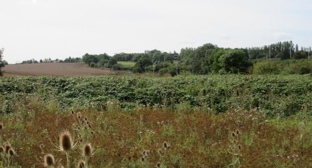
Figure 4 Looking south from the plant nursery towards Knebworth
A peaceful setting viewed from a position that is enjoyed by both the participants and customers of this important and well-loved local charity.
View 1 shown in Figure 41 is from the plant nursery currently known as 'Waste Not, Want Not', looking towards Knebworth. When this area is in full flower, it creates a colourful boundary between the nursery and the field. The B197 (Knebworth to Stevenage) is only distinguishable by a line of lampposts. This is a lovely rural view and its peaceful setting is a balm for both the volunteers and vulnerable people using the nursery. In the distance, the first few houses of Knebworth are just visible on the skyline as you look upwards over a rolling field. This will change colour through the seasons depending on the crop planted. From both scenic and social perspectives, the view provides a valuable resource within Knebworth's community. Any proposal for inappropriate development impinging on this view would be strongly opposed. Site KB4 in NHDCLP is situated just beyond the brow of the hill and should not rise above the skyline.
9.6.2 View 2: Looking past Oakfields Avenue towards Bragbury End
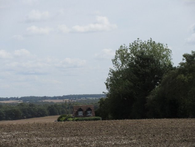
Figure 42 Looking past Oakfields Avenue towards Bragbury End (B197)
This view demonstrates the extent of the countryside in the parish and the village's rural atmosphere.
View 2 (Figure 42) looks towards Bragbury End and across the valley by Watton Road from the field entrance opposite Deards End Lane. There are mature trees and hedgerows both in the right foreground as well as the far distance. The attractive building visible is in Oakfields Avenue. This is a lovely rural view and epitomises the Hertfordshire countryside.
9.6.3 View 3: Looking south east from Oakfields Road and Oakfields Avenue junction
Figure 43 Looking south east from Oakfields Road and Oakfields Avenue junction
This is an important feature that helps define the village's rural character. It is much loved by ramblers and dog walkers.
View 3 (Figure 43) is recognised in the AECOM report (AECOM, Feb 2019)(section 4.6.1) as being an important part of the village's character. It looks towards the Watton Road across rolling countryside towards the dry valley south of Watton Road and is an important feature for the many dwellings that are adjacent to it. In addition, it is frequently used by ramblers and dog walkers.
It is recognised that this view overlooks part of KB4. However, there is a desire in the emerging NHDCLP to ensure that longer distance views into open countryside are maintained. These need to be fully considered in the design process with the active engagement of the stakeholders, particularly residents and others (such as walkers, school staff or pupils), to ensure that any proposal does not negatively impact on this view.
9.6.4 View 4: Watton Road looking west from the Bell Close junction
Figure 44 Looking into Knebworth from west
A tree lined entry into Knebworth that reflects the Garden City origins of the village.
View 4 shows a tree lined street which provides access into the centre of the village from the west (Figure 44). It is in keeping with the concept of the Garden Village and design principles underpinning the nearby Letchworth and Welwyn Garden Cities. Any future development would be expected to maintain the tree lined appearance.
9.6.5 View 5: Old Lane looking towards Bragbury End
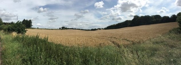
Figure 45 Looking from Old Lane to eastern parish boundary
A view from a typical single-track road that provides a lovely aspect over undulating countryside for the many walkers who use it.
View 5 is from Old Lane which is a single-track country road, partly flanked by a mature hedgerow including elder, brambles and trees such as oak. Its verges are filled with wildflowers and their seeds. Looking away from Knebworth, undulating countryside can be seen (Figure 45). Residents have used this as part of a circular walk from the 'high street' which encompasses several other scenic views (View 4 and View 6). This view looks over towards Pinker Wood.
The eastern edge of site KB4 overlooks this view. However, maintaining this view will enhance the amenity of the new developments and will also help maintain separation from the outskirts of Stevenage and Bragbury End.
9.6.6 View 6:Swangleys Lane looking west from Old Lane
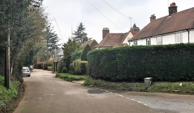
Figure 46 Swangleys Lane leading into Knebworth to the left and Old Lane to the right
A tree lined entry into Knebworth that reflects the Garden City origins of the village.
View 6 looks down one of the country roads leading into Knebworth with Old Lane joining it (Figure 46). Again, the road into Knebworth is tree lined and enhances the garden city feel.
9.6.7 View 7: London Road looking north from the southern Parish boundary
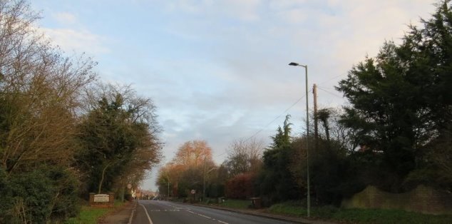
Figure 47 London Road looking north
A welcoming entrance into Knebworth with mature trees that lift the spirits.
View 7 looks into Knebworth on the London Road from Woolmer Green lined with mature hedges Figure 47. As the road approaches Knebworth, the large front gardens often have flowering trees which add to its attractiveness especially in Spring. Indeed, local residents have said that their spirits always lift when entering Knebworth village as the trees and hedgerows are so welcoming.
9.6.8 View 8: St Martin's Church, viewed from London Road
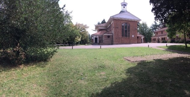
Figure 48 St Martin's Church (from B197)
A rare example of a religious building designed by Lutyens is seen in its green setting.
St Martin's Church and its extensive surrounding grounds are an integral part of village life (Figure 2). The graveyard (to left of church) is a peaceful location which has a calm atmosphere that can be enjoyed by both local residents and visitors to the village. This is probably the most looked upon view in the parish.
9.6.9 View 9: Gypsy Lane looking south east over Knebworth towards Datchworth
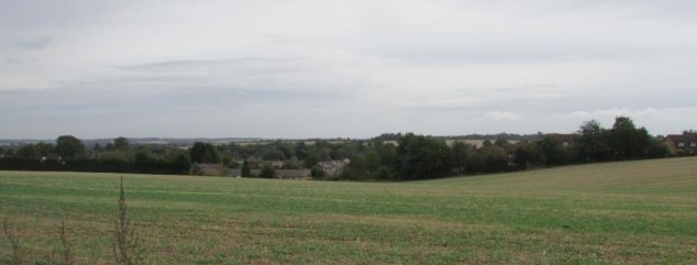
Figure 49 Gypsy Lane looking east over Knebworth towards Datchworth
A stunning view that opens up as you round the corner in Gypsy Lane and look east away from the A1(M).
View 9 (Figure 49) shows Knebworth village nestled in a wooded hollow with the hills in Datchworth in the distance. The view is visible through a gap in the mature hedges and across wide grass verges. Any development of the arable land in the foreground (part of KB2) would be expected to maintain this rural view.
9.6.10 View 10: Looking west to Rustling End from layby on Codicote to Hitchin road
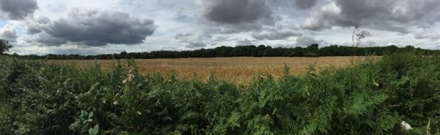
Figure 50 View east towards Rustling End (from layby on B656 – Codicote to Hitchin)
This view highlights the rural areas within the parish, with some of its mature woodland visible in the distance.
View 10 (Figure 50) looks to the west over generous verges filled with wildflowers towards extensive bluebell woods. It provides a scenic view over the Hertfordshire countryside from the Codicote-Hitchin road towards Rustling End (behind the woods). Rustling End is towards the north-west boundary of the parish. If dwellings were to be built in this rural area, this view would be adversely affected. In addition, there would be a risk that there would be loss of separation between Knebworth and the adjoining villages or towns (see also Policy KBDS1).
9.6.11 Character Area: Picton Houses
The properties fronting the eastern side of Stevenage Road and along Oakfields Road are mainly fine examples of the type of house that would have most likely been built if the Knebworth Garden Village had been completed.
The majority are detached, individually designed, red brick properties with red clay tiles. Many were built between the two world wars by local builders, two of which were the Picton Brothers. Over time the houses have become collectively known as the "Picton Houses". The building plots were sold by Knebworth Estate with deeds stipulating the types of acceptable building materials. The use of consistent materials for the houses mean that the entire row has a harmonious feel to it. Moreover, the design variations between individual houses provide interest.
The Picton Houses in Figure 51, Figure 52 and Figure 53, with their attractive gardens bordering wide roadside lawns, present a picture typical of the best of Knebworth and should be retained for the benefit of current and future generations. Furthermore, they exemplify good design principles, and these principles should be integrated into any future new developments.
Even on dull winter days (see Figure 52), the houses are still attractive particularly once the trees have shed their leaves. The evergreen trees help to provide winter structure.
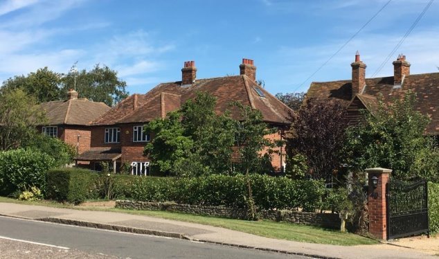
Figure 51 Variation in design between Picton Houses
Figure 52 Picton Houses in winter

Figure 53 Picton Houses along Oakfields Road
9.6.12 Character Area: Park Lane (east of A1(M))
Park Lane provides access from Codicote through the conservation area of Old Knebworth, crossing the A1(M) before it drops down into Knebworth village towards the Victorian Railway Station (Figure 55 (right)). It is flanked by mature hedges and trees throughout its entire length including the descent into Knebworth. When Park Lane enters Knebworth village, it contains an eclectic mix of houses and styles that range from the early buildings, others that have been in-filled and conversions of existing buildings.
Approaching Knebworth village a small collection of the older houses built prior to the expansion in the early 1900's can be seen on both sides of the road (Figure 54) and just beyond these at the entrance to Deards End Lane. They use both timber and flint as well as bricks in their construction and highlight the historical materials used in construction of dwellings.

Park Lane itself is tree-lined on the left with many mature shrubs on the right (Figure 55). This reflects Ebenezer's Garden City vision of bringing the countryside into the town providing a rural feel even though it is close to the centre of Knebworth. A wide range of styles and size of buildings can be seen (Figure 56), although importantly, none are out of keeping with the village and Garden City concept.

Figure 55 Tree-lined descent towards Knebworth Railway Station and the station

Figure 56 Park Lane looking west from the railway station
As Park Lane descends into Knebworth village the Victorian Railway Station, opened in 1884, can be seen at the bottom of the hill (Figure 55) (Wikipedia, n.d.). Many current commuters use the station and enjoy the benefits of a rural residential situation while still having access to London.
Just before Park Lane becomes Station Approach, two community buildings become visible. These are the Village Hall and Trinity Church (Figure 57). Trinity Church is listed in the Register of Buildings of Local Interest (NHDC, 2008). Above the entrance to Trinity church, a moulding containing its original name of 'Congregational Church' and construction date of 1887 can be seen, demonstrating its use as a building of religious significance for well over a century. The Village Hall is proposed in the Neighbourhood Plan as a Non-designated Heritage Asset.

Figure 57 Knebworth Village Hall (left) and Trinity Church (right)
(1) 9.7 Heritage Assets
The origins of Knebworth can be traced back to the Domesday Book of 1086 where it was referred to as Chenepeworde. Knebworth House and Knebworth village have had a long and influential history not only on the parish, but also many other areas in England and abroad. The tree-lined approaches and leafy aspects of the village are due to the influence of Ebenezer Howard's concept of a Garden City on Victor, Lord Lytton and his brother-in-law, the architect Edwin Lutyens. Not widely known is that Lutyens designed more buildings in Hertfordshire than any other county except Surrey. Knebworth is lucky to have many examples of these. In the past, the Lutyens Trust has organised tours of Knebworth viewing properties in Deards End Lane, the Golf Club, St Martin's Church, the Church of St. Mary and St. Thomas and 'Homewood' in Old Knebworth (The Lutyens Trust, n.d.).
Knebworth Parish is fortunate to have one Grade I listed building (church of St Mary and Thomas) three Grade II* buildings (Knebworth house (Figure 58 (left)), Homewood and Church of St Martin) and 50 Grade II listed buildings (The National Heritage List for England, n.d.). The list includes not only houses but also barns, tombs, churches and even a milepost. These buildings cover the full extent of the parish from Knebworth village through the conservation areas of Deards End Lane and Old Knebworth to the westernmost boundary of Rustling End.
Although St Martin's is relatively modern – it was built in 1915 – it is significant as it was designed by Sir Edwin Landseer Lutyens who had close links with Knebworth and the surrounding area (see Figure 18 (left)). The church plans specified that it should be built from the finest materials and most of these were locally sourced or produced. Lutyens designed very few religious buildings, and St Martin's is seen as part of his work that led to the design of Liverpool Cathedral.
The milepost (Figure 58 (right)) is interesting as it reflects the change in parish boundaries in 1911 as Knebworth was originally in the parish of Datchworth (Madgin, 2011).

Figure 58 Grade II* buildings - Knebworth House and Milepost opposite Trussell's butchers.
9.7.1 Archaeological and below ground remains
Knebworth Parish also contains important archaeological sites including three Scheduled Monuments. Two of these are surviving upstanding barrows in Graffidge Wood to the west - the first scheduled area contains a prehistoric (late Neolithic or Early Bronze Age) bowl barrow and a rare Romano-British barrow, the other a bell barrow of prehistoric date.
Should a development have potential to impact on any potentially significant archaeological remains an appropriate archaeological investigation should take place, as per NPPF paragraph 189: "Where a site on which development is proposed includes, or has the potential to include, heritage assets with archaeological interest, local planning authorities should require developers to submit an appropriate desk-based assessment and, where necessary, a field evaluation", and as per Policy HE4 of NHDCLP (NHDC, 2016). Should archaeological remains of significance be identified appropriate steps should be taken to mitigate the impact of development on the identified asset.
9.8 Policy KBEF6 Non-designated Heritage Assets
KBEF6 Non-designated Heritage Assets
Development proposals that affect non-designated heritage assets, which are not already statutorily protected through listing or scheduling, will be permitted provided that the scale of any harm or loss is balanced against the significance of the asset.
A number of Non-designated Heritage Assets are described in the Knebworth Register of Buildings of Local Interest (NHDC, 2008) including: War Memorial, Park Lane; The Lytton Arms, Park Lane; Old Nursery School, Park Lane; Rose Cottage, Park Lane; Trinity Church, Park Lane; Knebworth School, Swangleys Lane; No. 115 London Road; Hillcroft No. 7 Deards End Lane; Woodland No. 18 Deards End Lane; St Thomas More Catholic Church, No. 72 London Road; Knebworth Railway Station, Station Approach; The Station public house and outbuilding, Station Approach; and The Cottage, Three Houses Lane.
In addition, the following buildings are worthy of protection as Non-designated Heritage Assets:
- Knebworth Village Hall
- 1, 3 & 5 Station Road
- 143 London Road
- 23 Station Road
This policy also applies to any Non-designated Heritage Assets which may be identified in the life of the Neighbourhood Plan.
A new initiative was launched in September 2019 by the Ministry of Housing that will help to ensure local buildings that are preserved for future generations (CLG, n.d.) by encouraging Non-designated Heritage Assets to be identified during the preparation of neighbourhood plans. Local heritage can help the community thrive as well being of interest to both residents and visitors.
NHDC Register of Buildings of Local Interest contains 15 entries in total, of which ten entries are in Knebworth village, four are in Old Knebworth and one is in Three Houses Lane (western parish boundary). Many of the buildings relate to Lutyens and the development of the railway.
Unfortunately, 111 London Road, though still retaining the same basic silhouette, appears to have lost much of its finer detail following its redevelopment. This can be seen when comparing the images in the original listing and current images. It is important that care is taken in securing the essence of these buildings as and when they are redeveloped or repaired.
9.8.1 Knebworth Village Hall
The Village Hall (see Figure 57 (left)) is situated in the Park Lane Character Area. Outside, the building has attractive pale pink plasterwork for the ground floor with black stained timber detailing on the main and side entrances that picks up the black line at the base of the walls. Inside, there is a large main hall and stage with a striking exposed beam roof and wooden floor. The Village Hall is not listed as a designated asset but there is a compelling case for it to be included (NHDC, 2008).
9.8.2 1, 3 & 5 Station Road
These Lutyens designed shops, 1, 3 & 5 Station Road (See Figure 3 (right)), are attractive 2 and a half storey red brick building with original tiled roof and three pitched roof gables, occupied by three local businesses.
9.8.3 143 London Road
Trussell's butchers, 143 London Road - formerly Farrin's (Figure 59 (right)) has been a butcher's shop for many years (Madgin, 2011, p. 56). It was the first shop to open in London Road and was originally built to ensure that the meat did not receive excessive heat and cause the contents to go off as refrigeration was not widely available at the time.
It is constructed of red brick with interest created by the use of vertical timber boarding details under the gables and original tiled roof and chimney remaining. The attractive sash windows have an unusual three panel window layout (18 over 3 panes).
9.8.4 23 Station Road
Jacob House, 23 Station Road is now occupied by Burgess & Sons (Madgin, 2011, p. 43) (Figure 59 (left)). It is located opposite Trussell's butchers. It originally contained a grocer's shop with Post Office and a bakery next door.
The key features of the property are the red brick with dentil course under each gable and rubbed red brick arches over windows.

Figure 59: 23 Station Road (left) & Trussell's Butchers 143 London Road (right)