Codicote Neighbourhood Plan 2024 - 2031 Submission
Appendix O – Non-designated Heritage Assets
Policy Map Extract
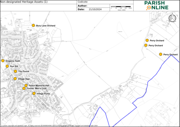
Peace Memorial Hall, High Street (TL21671816)
The village hall, also known as the Peace Memorial Hall, stands in front of the Village Museum, on the High Street. It was built after the Men's Club, in 1927.
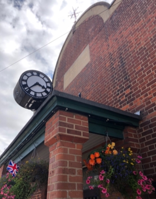
Figure 44: Peace Memorial Hall
Former 'Men's Club', behind Peace Memorial Hall, High Street (TL21651815)
Currently used as the Village Museum. It is an Edwardian timber and iron building, originally a Men's Club, and later used by the British Legion and pre-school group.
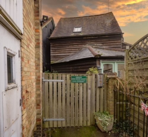
Figure 45: Men's Club (behind Peace Memorial Hall)
Codicote Village Sign, High Street (TL21561824)
Metal village sign situated on the village green in the High Street. Mentioned in the Codicote Conservation Area Character Statement Fig 2.4 in the character photo section. The sign was designed in association with residents. Dates from 1995. The sign consists of four quadrants, each with a different image: Top left – St Giles Parish Church in Bury Lane. Top right – Arms of John Penne, Barber Surgeon to Henry VIII and Lord of the Manor of Codicote.
Bottom left – Ancient wood carving known as the Old Dog in the Codicote Parish Church.
Bottom right – 14th century building in the High Street, originally a hostelry and later a coaching inn (now residential).
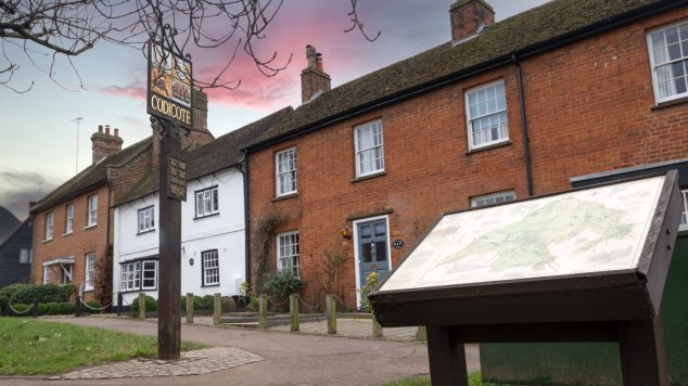
Figure 46: Village Sign on Village Green
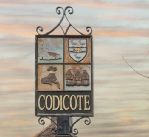
Figure 47: Detail of Village Sign
'Dragons Teeth', west side verge, north of Bury Lane, High Street (TL21441843)
Situated on the west side of the High Street to the north of its junction with Bury Lane there are a number of "dragons' teeth" half buried in the verge. These are concrete blocks placed there during the Second World War ready to pull across the main road to Hitchin if invading German tanks approached, to give the Home Guard time to slow down their progress.
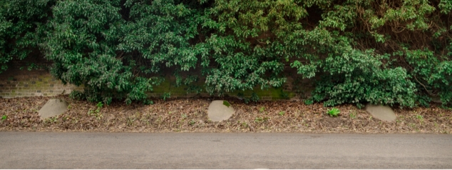
Figure 48: Dragons Teeth, High Street
Gun Slit in wall opposite Bury Lane, High Street (Tl214821837)
In the brick wall opposite Bury Lane there is a gun slit framed in metal, placed there so that the Home Guard could fire across the High Street on German invaders approaching along Bury Lane.
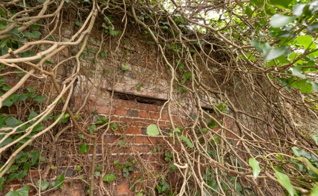
Figure 49: Gun Slit in wall, High Street
'The Pound', enclosure between the former Bell Inn and Pond House, behind High Street (TL21571832)
In the bridleway between the former Bell Inn and Pond House is a small enclosure which is said to have been the Pound, where stray animals were impounded until their owners reclaimed them and paid a fine. The widening in the pavement adjoining was once the site of the "Town Well" and later a public pump, as well as the "Cage" a small lockup for petty criminals. No trace of either survives.
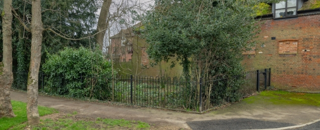
Figure 50: 'The Pound' Enclosure (LGS10)
Village Pump, west side of High Street (southern end) (TL21761809)
Towards the south end of the on the west side of the High Street is the sole surviving public pump of the two formerly existing, where villagers who didn't have their own well or pump collected their water.
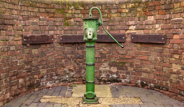
Figure 51: Village Pump, High Street
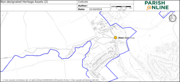
Cart ramp near Fulling Mill, Fulling Mill Lane (TL22601697)
In the banks on the River Mimram, near Fulling Mill, there are the fragmentary remains of a concrete ramp which farmers used to take water carts into the river to fill them up.
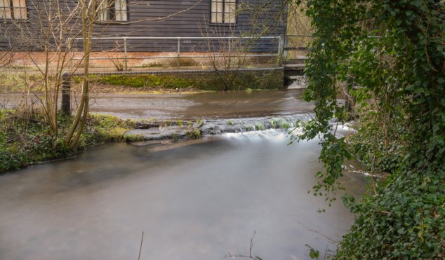
Figure 52: Cart Ramp near Fulling Mill
Community Orchard, Bury Lane (TL21751879)
(see also references to the orchard in the Local Green Space and Valued Community Facilities sections of this Plan)
The orchard contains ancient varieties of fruit e.g. plum, apple and pear trees.
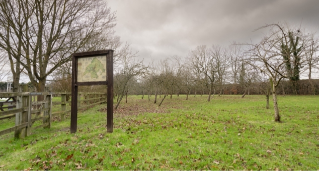
Figure 53: Community Orchard, Bury Lane and LGS3
Traditional Perry orchard, Rabley Heath Road (TL22931859)
Remains of Perry Orchard. Perry orchards are usually found in the West Country, so this is unusual in Hertfordshire.
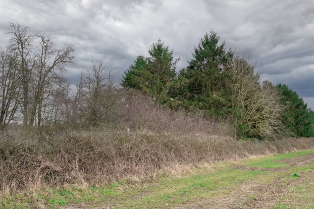
Figure 54: Traditional Perry orchard, Rabley Heath Road
In addition to the Non-designated heritage assets included in Policy COD 20, the following in formation has been collated by Hertfordshire Gardens Trust (HGT), from existing recorded information. HGT have this park and garden in their local list of parks and gardens (see below).
Node Park
Grid Reference TL 213 200
Node Park Sites and Monuments Record MHT9592 (extract)
Early 19th century park with good garden features (1501 to 1900).
Significant park shown on Bryant's 1822 map and on the 1st ed. OS map (1832-33) and on E Stanford's map of c.1925. 1990 aerial photomap shows a superb parterre garden south-west of the house, a formal canal garden to the north-west, a nice park and tree avenue. The 'celebrated gardens' and 'finely timbered parkland'; including a formal garden with ha-ha, large rock garden with water, and a rose garden.
At the north end is the Peach House, a Listed building attributed to Joseph Paxton and with the date 1854 etched on one of the glass panes. It is currently in very poor condition.
The gardens include a formal Arts & Crafts garden, and two rock gardens (one now in separate ownership).
What had been a small farmstead 'became a country estate from 1811'; by 1841 the house [30336] had been enlarged and the fields south of the house were emparked, by the owner William Leeson. By 1881 the house had been enlarged again, and improvements in the park included terracing south and east of the house, the construction of stables, kitchen garden and other garden features including the walled garden with Paxton's peach house, and realignment of the drive. Some of the earlier features were removed between 1898 and 1924, and glasshouses added. In 1926 the estate was bought by Carl Holmes, an American, who greatly enlarged and embellished the gardens. These included a Japanese garden 'designed by a Professor from the Imperial School of Gardening in Tokyo' and constructed in part by men brought in from Japan. Rock used in the Japanese garden was genuine, but a knot garden and a water garden laid out at the same time used Pulhamite. Holmes also had the interconnecting lakes south of the house dug by local unemployed men. Only some of all this survives, including rare trees planted in the Japanese garden (1900 – 2000).
Hertfordshire Gardens Trust noted the Pulham rockery and arch, Japanese garden by renowned Prof. Suzuki, walled kitchen garden, with peach house and apple store of outstanding Arts and Crafts design.
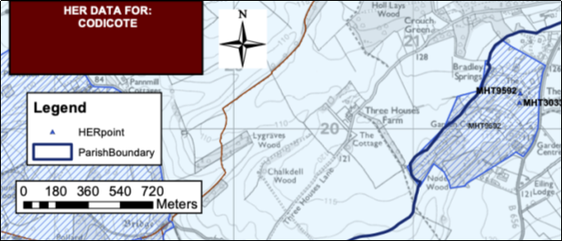
Extract from Hertfordshire County Council map Copyright 1000019606 2023
In an article titled The Pullman Legacy it was noted that the two large artificial interconnecting lakes, the Japanese garden and the archway folly had been sold off and are no longer part of the estate.
2000 to present day
The Node became a 'state of the art' conference centre in 2000 but was later turned into luxury apartments.
Herts Advertiser Property Spotlight 2017 noted that The Node manor house is set within 15 acres of stunning grounds, which include open fields, formal Italianate gardens with original fountain and statues, natural woodland walks, including a water rock garden and a sunken garden. Image below taken from this article and attributed to the Herts Advertiser.
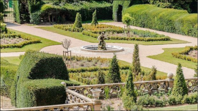
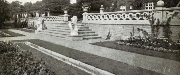
Figure 55: Italianate Gardens and Balustraded Terrace taken from the Sunken Garden
(Picture from the Pulham 'Garden Ornament Catalogue' c1925)
