Codicote Neighbourhood Plan 2024 - 2031 Submission
Appendix F - Local Green Spaces
The following tables evidence the assessment of the Local Green Spaces designated in this Plan. Table 1 considers designations, Table 2 considers criteria in the NPPF, and Table 3 provides evidence of why these spaces are special to the community and deserve Local Green Space Status. These are followed by detailed maps of the LGS and photographs of LGS where they are not already referenced throughout the Neighbourhood Plan document.
Table 1 Local Space Assessment: Designations
|
Site description |
No |
Potential Develop-ment site |
Other designation |
Common or Village Green |
Garden |
Planning App |
|
Bury Lane Sports Field |
LGS1 |
N |
Recreational Open Space |
N |
N |
N |
|
Allotments, Bury Lane |
LGS2 |
N |
Allotments |
N |
N |
n |
|
Orchard Bury Lane |
LGS3 |
N |
Non- designated heritage asset |
N |
N |
N |
|
St Giles Church Yard |
LGS4 |
N |
Grade II* listed, Important View 4, 13 |
y |
y |
N |
|
Land east of Codicote High St. |
LGS5 |
Y |
N/A |
N |
Y |
N |
|
Whitwell Road Wood |
LGS6 |
N |
NERC Priority wildlife habitat, Green Corridor, Public Footpath 2 |
Y |
N |
N |
|
Codicote Heath |
LGS7 |
N |
Important View 11, Public Footpaths |
Y |
N |
N |
|
Heath plantation |
LGS8 |
N |
LWS and NERC Priority Habitat, Green Corridor, Public Footpaths |
Y |
N |
N |
|
Grass verge west side of High St. |
LGS9 |
N |
Important View 9 |
Y |
N |
N |
|
The Pound |
LGS10 |
N |
Non- designated Heritage Asset |
Y |
N |
N |
|
Village Green |
LGS11 |
N |
Site of Non- designated Heritage Asset Important View 9 |
Y |
N |
N |
|
Dark Lane |
LGS12 |
N |
PROW UCR 2 Important View 2 |
Y |
N |
N |
|
Singlers Marsh, Codicote Road |
LGS13 |
N |
Local Nature Reserve |
N |
N |
N |
|
Vale Orchard High St. |
LGS14 |
N |
N/A |
N |
N |
N |
Table 2 Local Green Space: NPPF Criteria
|
Site description |
No |
Size (ha) |
Local in Character |
Extensive Tract of Land |
Very Special to the Community |
Close to the Community it Serves |
|
Bury Lane Sports Field |
LGS1 |
2.361 |
Y |
N |
Y |
Y |
|
Allotments, Bury Lane |
LGS2 |
1.023 |
Y |
N |
Y |
Y |
|
Orchard Bury Lane |
LGS3 |
0.321 |
Y |
N |
Y |
Y |
|
St Giles Church Yard |
LGS4 |
0.965 |
Y |
N |
Y |
Y |
|
Land east of Codicote High Street |
LGS5 |
0.188 |
Y |
N |
Y |
Y |
|
Whitwell Road Wood |
LGS6 |
1.546 |
Y |
N |
Y |
Y |
|
Codicote Heath |
LGS7 |
6.939 |
Y |
N |
Y |
Y |
|
Heath plantation |
LGS8 |
4.230 |
Y |
N |
Y |
Y |
|
Grass verge west side of High St. |
LGS9 |
0.047 |
Y |
N |
Y |
Y |
|
The Pound |
LGS10 |
0.013 |
Y |
N |
Y |
Y |
|
Village Green |
LGS11 |
0.025 |
Y |
N |
Y |
Y |
|
Dark Lane |
LGS12 |
0.319 |
Y |
N |
Y |
Y |
|
Singlers Marsh, Codicote Road |
LGS13 |
1.12 |
Y |
N |
Y |
Y |
|
Vale Orchard High St. |
LGS14 |
0.6 |
Y |
N |
Y |
Y |
Table 3 Local Green Space: Special to the Community
|
Site description |
No |
Attractiveness of Site |
Historical Signifi-cance |
Recreation Use |
Tran-quillity |
Wildlife |
|
Bury Lane Sports Field |
LGS1 |
Sports facility with extensive views over surrounding countryside |
Group with allotments LGS2 and orchard LGS3 |
Public access by foot and by car |
Yes |
Hedgerows provide wildlife habitat |
|
Allotments, Bury Lane |
LGS2 |
Site adjoins LSG2 and LGS3. Well maintained allotments surrounded by established hedgerows |
Group with Bury Lane Sports Field LGS1 and Orchard LGS3 |
Accessible by car from Bury Lane and footpaths off St Giles Road |
Yes |
Established hedgerows provide habitat for wildlife |
|
Orchard Bury Lane |
LGS3 |
Contains ancient varieties of fruit e.g. plum, apple and pear trees. Spring blossom and summer fruit. |
Group with Bury Lane Sports Field LGS1 and Allotments LGS2 |
Accessible on foot and for fruit picking, Small social space for families |
Yes |
Provides unique wildlife habitat providing food in winter |
|
St Giles Church Yard |
LGS4 |
Village church, located in a well-kept cemetery, with sheep grazing. Bounded on 2 sides by ancient hedges with views to the northeast across rolling fields. |
Grade II* Medieval church surrounded by fine examples of flint walls. Established focal point with war memorial. |
Place of worship and remembrance and used for community events. |
Yes |
Local Wildlife Site 43/047 |
|
Land east of Codicote High Street (opposite North Lodge) |
LGS5 |
Small green site surrounded by hedges and houses. |
N |
Used as play space for children and informal gardening |
Yes, despite being adjacent to road |
Not established |
|
Whitwell Road Wood |
LGS6 |
Established woodland, bounded by fields |
N |
Popular footpath to Codicote Heath from village |
Yes |
NERC Priority Habitat |
|
Codicote Heath |
LGS7 |
Wild expanse of heathland with hedgerows and woodland adjacent to LGS8 |
N |
Popular footpath across Heath to village |
Yes, very |
Adjacent to LWS 43/018/01 NERC Priority Habitat |
|
Heath plantation |
LGS8 |
Established woodland with footpaths, leading to Kimpton Mill, adjacent to LGS7 |
N |
Contains public footpaths well used by walkers on the Heath |
Yes |
LWS 43/018/01 NERC Protected Habitat |
|
Grass verge on W side of High Street |
LGS9 |
Typical village verge with seasonal flowers, bounded by fine examples of flint walls |
N |
N |
Yes |
Not established |
|
The Pound |
LGS10 |
A curiosity used in past as holding pen for animals |
Linked to medieval markets on village green opposite |
N |
Yes |
Not established |
|
Village Green |
LGS11 |
Attractive green on High Street with seasonal flowers and Walnut tree. |
Village Green with village sign and stocks reflecting bygone age |
Seating area used for resting |
Yes, despite its location on High Street |
Walnut tree attracts wildlife |
|
Dark Lane |
LGS12 |
Pretty sunken avenue path leading from village to Mimram stream, bordered by trees and fields |
Historic footpath to village stream |
Popular with walkers |
Yes, very |
Wildlife in hedgerows along the lane |
|
Singlers Marsh, Codicote Road |
LGS13 |
Local Nature Reserve with a variety of habitats |
Originally marshy fertile meadows for grazing |
Public open space used by walkers, for fun runs, picnics |
Yes, very |
Priority Habitat and managed for nature |
|
Vale Orchard, High Street |
LGS14 |
Site has been planted as a community orchard |
None |
Public access to orchard |
Yes |
Not established |
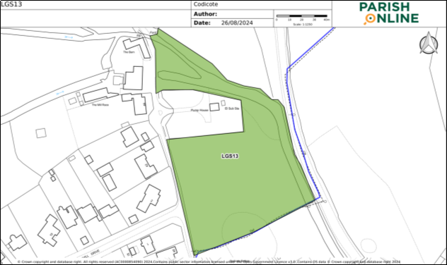
Figure 17 Policies Map Extract LGS 13
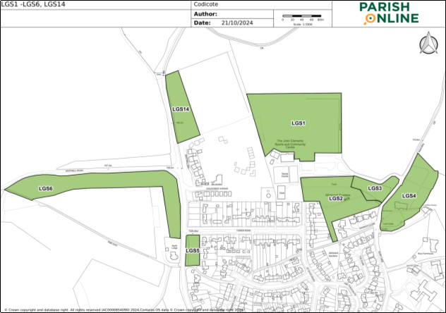
Figure 18: Policies Map Extract LGS 1 – LGS 6 & LGS 14
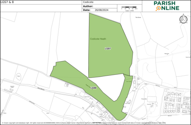
Figure 19: Policies Map Extract LGS 7 & 8
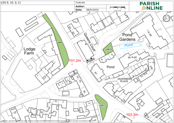
Figure 20: Policies Map Extract LGS 9, 10, & 11
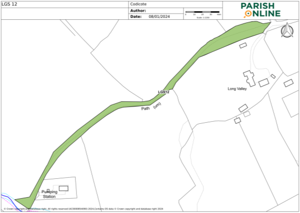
Figure 21: Policies Map Extract LGS 12
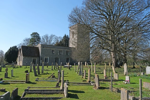
Figure 22: St Giles Church Yard LGS4
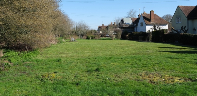
Figure 23: Land East of Codicote High Street LGS5
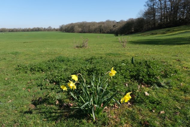
Figure 24: Codicote Heath LGS7
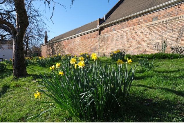
Figure 25: LGS9 Grass Verge on West Side of High Street
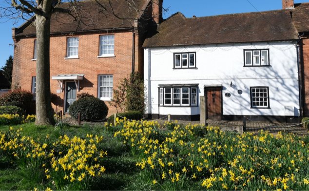
Figure 26: Village Green LGS11
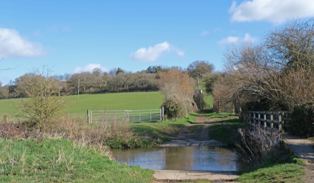
Figure 27: Dark Lane LGS12
