Wallington Neighbourhood Plan 2022 - 2031 Submission Version June 2023
(2) 14 List of evidence documents
All documents are available to view on the Wallington and Rushden Parish Council website:
Document website addresses correct at March 2023:
Document/ Evidence
Author
Year
Hertfordshire Environmental Forum
1998 (amended 2006)
Woodland Trust
2008
Hertfordshire County Council Monument Full Report
Hertfordshire County Council
2021
List of finds from Wallington registered with the Portable Antiquities Scheme
2021
NHDC
2021
Wallington Design Guidelines and Codes
WPC
2021
Appendix A – Profile of the Neighbourhood Area
Due to its size, the Profile of the Neighbourhood Area document is saved separately.
Appendix B – Criteria used to define the built core of Wallington village
Government guidance recommends that a set of criteria be used when defining the settlement boundary or built core of a settlement.
Such boundaries can exclude large gardens, orchards and other areas, which are considered to contribute significantly to local character. This may mean that occasionally the boundaries do not relate fully to the physical features surrounding the village. For Wallington, areas identified within the Wallington Conservation Area Character Statement as significant green space[1] and significant trees contributing to the Weston-Green End Plateau Landscape Character Area, have been excluded from the built core.
The following criteria have been used in determining the built core for Wallington, with a commentary provided against each.
Criteria
Commentary
Lines of communication - The boundaries trace the edge of the built up area, therefore excluding roads, paths, railways and other lines of communications.
The boundary excludes lines of communication.
Physical features - Wherever possible try to allow the boundaries to follow physical features, such as: buildings, field boundaries or curtilages. However, in order to conserve the character and to limit expansion, settlement boundaries can exclude large gardens, orchards and other areas. This may mean that occasionally the boundaries do not relate fully to the physical features surrounding the village.
The boundary has been drawn to exclude 'significant green space' within the village, as identified in the Wallington Conservation Character Area Statement. These are considered to contribute significantly to the local character of the area and should be safeguarded against development.
Planning History / Recent Development - You may wish to consider existing commenced planning permissions, recent refusals, planning appeal decisions and previous Local Plan inspector's comments concerning areas on the edge of the village.
Where appropriate, settlement boundaries should include new developments which may have occurred recently. It is also advisable to include sites that have received planning permission within the settlement boundary.
The monitoring data held by NHDC records that two applications have been granted permission since 2011:
09/01849/1 Land at Baldock Radio Station, Royston Road, Wallington: Change of use of land to provide new racehorse training facilities comprising 42 stables including feed, tack storage and office, two storage barns, one equine pool with plant room, solarium and sandroll, one warm up track, one horse exerciser and one six-furlong gallop. Associated staff accommodation comprising one Trainer's house, one temporary Assistant Trainer's mobile home and one temporary two bed staff mobile home. Associated works, access tracks and widening of existing vehicular crossover onto A505. (As amended by plans received 15th December 2009). (The planned development was never built).
13/01005/1: Bygrave Lodge Farm, Wallington, SG7 6QX: Single storey extension to existing crew hut to provide 4 bedroom dwelling for seasonal agricultural workers.
No new planning applications for new dwellings are pending
Village enhancements - Settlement boundaries should include buildings and associated land that make up the village form. In some edge of village areas, boundaries may need to include small areas of land and/or buildings which offer the opportunity for improvements to the entrance of the village or ensure infrastructure improvements or a general enhancement to the village
The primary entrance to village is along Wallington Road, leading into Kitt's Lane.
Secondary entrances – particularly by foot – are:
- The track to the west of the church (footpath/bridleway).
- The eastern end of The Street, connecting the village to neighbouring Sandon, some 2 miles to the east.
- The northern end of The Street (footpath/bridleway).
Important amenity areas - These form part of the character of the settlement and could be identified and protected by policy and included in the settlement boundary due to their contribution to built form.
Important amenity areas that contribute to the built form in Wallington are:
- The church and grounds
- The village hall and playground
- The village hall field, 'The Wick'
- The ponds
- Mutcheaps Field
- The Park
- 'Townsend Field'
- Plough Paddock
- New Close
Some of these are to be designated as Local Green Space
The Conservation Area covers a large proportion of the village.
The built core has been drawn to facilitate an appropriate level of proportional growth within the plan period, which is anticipated to be small in scale. There are no site allocations within the emerging Local Plan pertaining to Wallington.
[1] https://www.north-herts.gov.uk/sites/default/files/Wallington%20CA%20Character%20Statement.pdf
Appendix C – Wallington Design Guidelines and Codes
Due to its size, the Wallington Design Guidelines and Codes document is saved separately.
(1) Appendix D – Non-designated heritage assets
There are 19 individual/ collections of historic buildings and structures currently nationally listed in Wallington. A list can be found here: https://britishlistedbuildings.co.uk/england/wallington-north-hertfordshire-hertfordshire. The following non-nationally listed assets were identified as being of local historic interest and are identified as non-designated heritage assets.
1. Village Hall
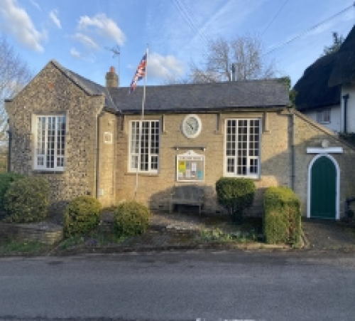
Address: The Street
Significance: Aesthetic, historical and community value
Asset type: Building
Description of local significance: The Village Hall was originally the Village School and funded along with a separate house for a school mistress by bequest from a local church minister. The main school building dates from the mid 19th century but ceased use as such in the 1930s, other than during the Second World War when it was reopened to help support evacuee children.
Since then, it has served as a Village Hall and important social hub for the village. Architecturally of note are the traditional Hertfordshire flint SE wall and the external clock which requires regular hand winding. Photographs of the front of the hall are regularly used in both District and County Council publicity.
---
2. Village Bus Shelter
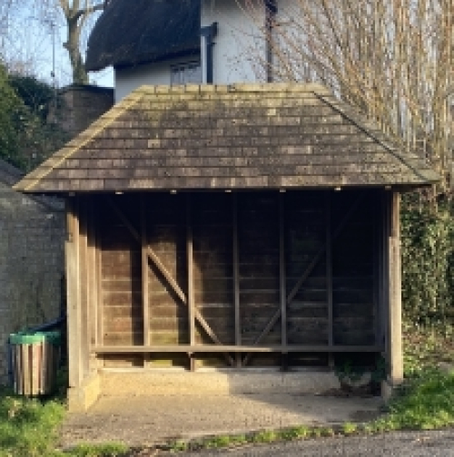
Address: The Street (outside the Village Hall)
Significance: Aesthetic, historical and community value
Asset type: Outdoor structure
Description of local significance: Wooden Structure with internal bench seating and peaked shingle roofing. Built in 1960s and repaired in the 1990s by community effort. It provides shelter for walkers etc. in inclement weather. Although there are no scheduled bus services, it remains a pick-up point for the school bus, and is currently a designated stop for the HertsLynx on-demand bus pilot scheme.
----
3. Well Pond Structure
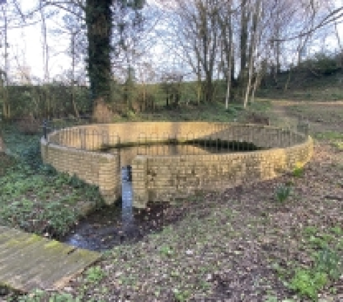
Address: Just off the Street to the south of the village
Significance: Aesthetic, historical and community value
Asset type: outdoor structure
Description of local significance: The well pond was the main source of water for the village since at least Domesday Book times until the provision of mains water in the mid 20th century and water still flows constantly from the spring all year round. The original date of the brick structure is unknown. It may be mid-Victorian, like many other improvements to the village led by Rev George Robert Tuck. It had fallen into disrepair and was rebuilt during the 1980s as part of a youth training scheme. Its surrounds were a traditional gathering site for villagers.
---
4. 11 – 13 The Street
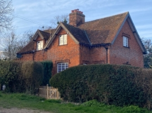
Address: 11-13 The Street
Significance: Aesthetic, historical and community value
Asset type: Building (pair of semi-detached cottages)
Description of local significance: This pair of mid-Victorian cottages are examples of cottages in traditional Hertfordshire vernacular with key architectural features being the hood mouldings above the windows and doors. A number of original windows enhance the attractive aspect of the cottages and the westerly facing roof features traditional clay peg tiles.
---
5. Village Pump
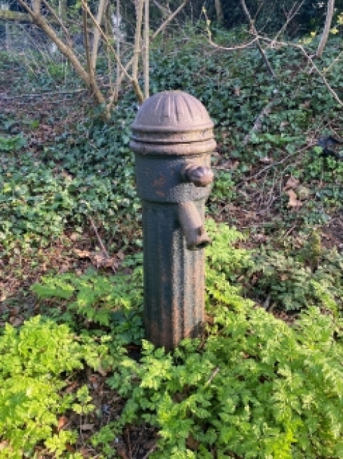
Address: located on the grass verge, close the boundary between The Wick and the village hall play area.
Significance: Aesthetic, historical and community value
Asset type: infrastructure/ water pump
Description of local significance: Wallington has benefited historically from natural springs and ponds arising from the underlying chalk strata. Before the arrival of mains water in the mid-20th century, this pump, which is situated to the south side of the lower Street adjacent to the playground and the Wick, was the main water source for most of the village. The pump is mentioned in the diaries of George Orwell.
Appendix E - Detail of locally significant views
Number
Description
Photograph
KV1
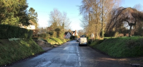
From The Street, looking north, illustrating its enclosure from buildings rising from behind narrow planted strips and tree growth which produces a tunnel effect.
(Photo needed from further down the road, showing Derby Arms Cottage)
KV2
From the junction of The Street and Kit's Lane, looking south, showing the Grade II listed late 16th century 3 and 5 (1176371). Its retained jettied side elevation on the road provides a historic interest to the area. Manor Farm Great Barn (1176396) is a key part of the farmyard that inspired Orwell's Animal Farm.
The two ivy-clad stumps mark the start of the old postmans path, which cuts across Mutcheaps and the Chase Meadoes to KV12.
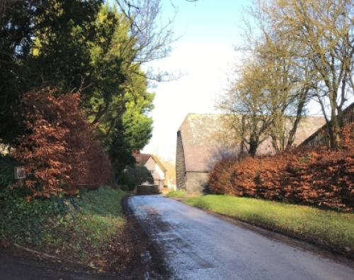
KV3
From Kit's Lane, looking east, depicting the hollow way, which defines the street with greenery and margin planting. The chimney stack of the former Plough Public House (1102682) is highly visible in the background.
KV4
From The Street, looking north, past the Grade II listed late 16th century 3 and 5 (1176371), and the Grade II listed Great Barn at Manor Farm (1176396), a key part of the farmyard associated with Orwell's Animal Farm, toward the junction with Kit's Lane and the former Plough Public House (1102682) in the background.
(Photo needed from further down the road, to show view of The Plough between the barn and 3/5 Kit's Lane)
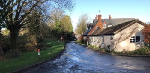
KV5
From the southern end of The Street, looking north, past non-designated buildings making up the street frontage (2–4, The Street) and Manor Farm, with 3-5, The Street (1176371) visible in the distance through the trees.
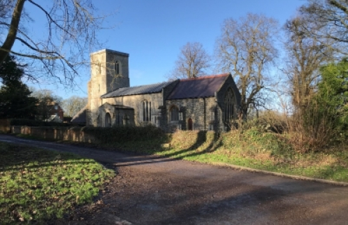
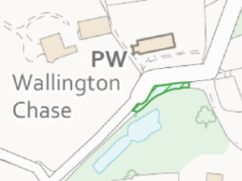
KV6
From south-east of the Grade II* Church of St Mary (1347337), looking toward the church. This view shows the scale of trees, and the sense of enclosure in and around the church which limits views of the building. In the background is the gable of Wallington Chase, the former rectory and some of the numerous trees planted around the house to form the pleasure grounds.
KV7
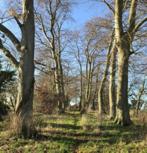
View along FP44 across "The Park" (significant green space in the Conservation Area Character Statement), between the avenue of trees.
KV8
View across "The Wick" from The Street towards Manor Farm and Manor Farmhouse.
KV9
View across open countryside from the Southern end of "The Back" (FP32) looking in an Easterly direction. The footpath s thought to date from at least the medieval period and is a prominent feature of a 'strip' village layout.
KV10
View across open countryside in a South- and Westerly direction from FP47 close to its intersection with the Western end of Church Lane. (Eastern end of the Chiltern Hills)
KV11
View across "The Warren" towards Quickswood along FP36 towards its junction with FP45 and Bury Wood, encompassing natural ponds and thickets within the "The Warren" field, plus remnants of ancient structures including mounds identified as kilns by renowned archaeologist Tony Rook. (Eastern end of the Chiltern Hills)
KV12
View across open countryside in a Westerly direction from the intersection of FP47 and FP22 close to the North Western corner of the garden of The Chase. (Eastern end of the Chiltern Hills)
KV13
View across open countryside in a West and North-Westerly direction from a bend in FP26, alongside the Western edge of the "The Park". (Eastern end of the Chiltern Hills)
KV14
View across open countryside and the Northern end of The Street from the junction of FP25 and FP26, facing in a North Easterly direction. (From the Eastern end of the Chiltern Hills, looking towards Cambridgeshire)
KV15
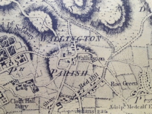
View towards Wallington from Wallington Road from the crest of the hill, showing the ring of trees surrounding the village, so that no houses are visible. (Map 2)
KV16
View towards Wallington from the junction of FP33 with Cat Ditch Road, showing trees and hedges surrounding the village. Only Manor Farmhouse and Bury Farm buildings are visible. At least three types of orchid have been spotted in the bordering set-aside strip.
KV17
View from FP27 towards Sandon and Redhill, at the highest point – the kissing gate where the footpath passes from New Close Meadow to New Close Field, adjacent to Wallington Bury Farm barns.
KV18
View from FP27, New Close Meadow, towards the duck pond and village, with Well Pond area of trees to the left, and Mutcheaps Meadow beyond the pond.
This view also takes in possible house platforms (to the right), noted by Gill Burlie Letchworth, the archaeologist who supervised the digging of the Roman cemeteries at Baldock.
KV19
View of church and duck pond area across Mutcheaps Meadow from the junction of FP31 and FP22.
KV20
View across Chase Meadow from the junction of FP31 and FP22.
KV21
View towards duck pond area across Mutcheaps Meadow from St Mary's Churchyard (church path)
KV22
View from duck pond towards St Mary's Church (Grade 2* Listed) across Mutcheaps Meadow
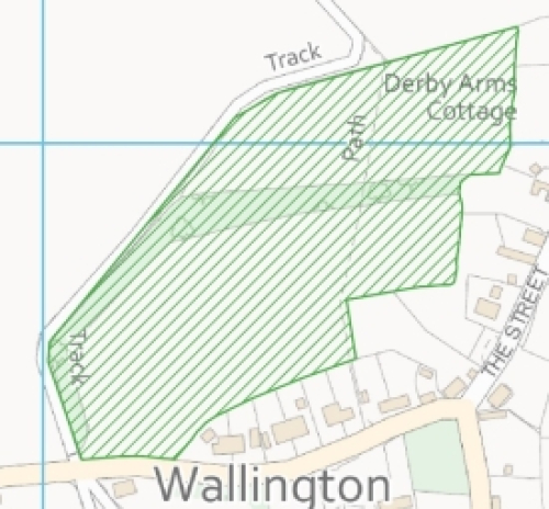
Appendix F – Detail of Local Green Spaces
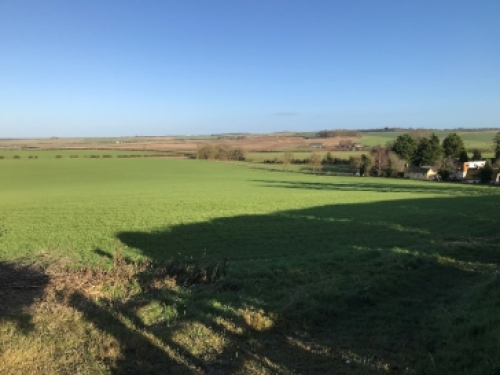
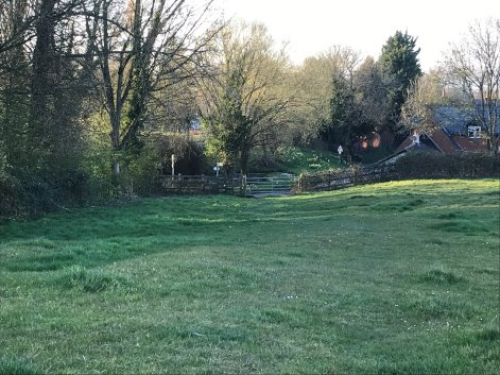
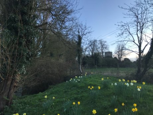
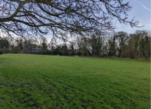
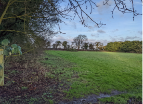
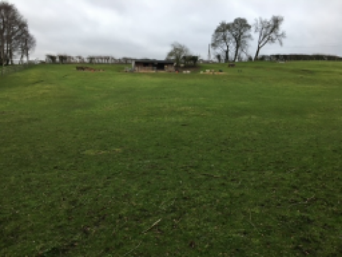
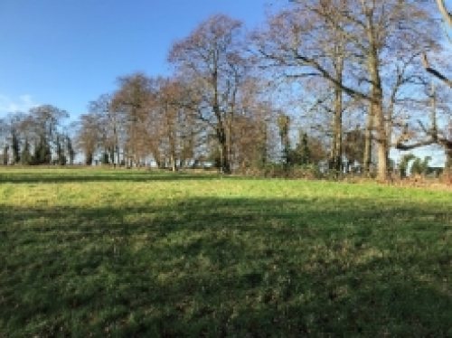
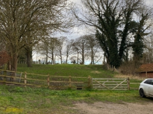
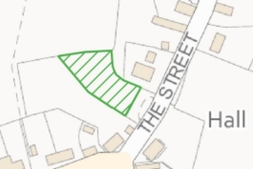
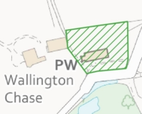
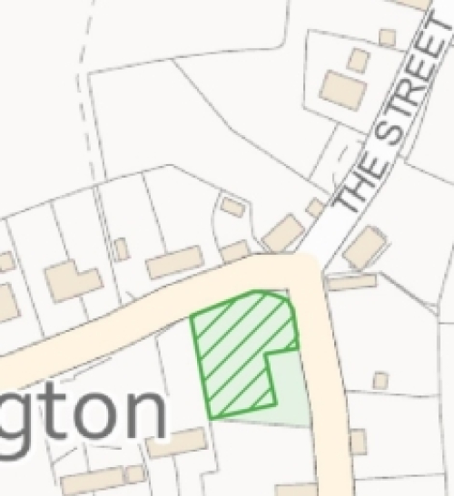
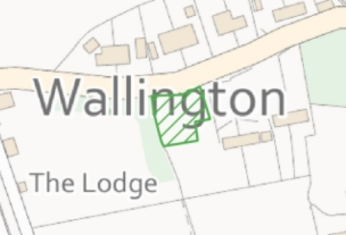
LGS1: Mutcheaps Field
Address and location
Field located to the north of Wallington Churchyard.
Ownership details
Privately owned.
Description and purpose / current use
This is an open field located to the north of Wallington churchyard.
Any designations
None.
Site allocations in Local Plan
None.
Planning permissions?
Ref: 21/02860/FP - Change of use from agricultural land to residential garden land, submitted 05/10/2021.
Access & proximity including how close to the community it serves
The field sits at the heart of the village, immediately behind the Church, and is speculated to be the location of some of the earliest settlements in the area. A footpath runs parallel to its western boundary.
Demonstrably Special?
Wildlife: There have been sightings of ring ouzels using the field in both spring and autumn as a stopover during migration. Ring ouzels are a Red List species of conservation concern in the UK. Buzzards and barn owls regularly patrol the field. Common shrew and field vole are present based on sightings along the adjoining footpath. There are also rabbits, muntjac and signs of badgers on the adjoining path.
Beauty: The view from The Street across the North Eastern corner of the field toward the Church is highly valued and was mentioned by 11 respondents to the Green Spaces survey carried out within the village.
Historic: Registered site of possible archaeological interest.
Local in character?
Yes. 0.149 ha.
Photo
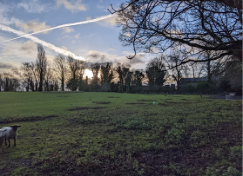
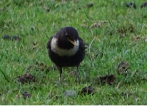
Photos show the field and a ring ouzel, taken in April 2020
Map
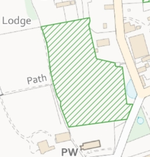
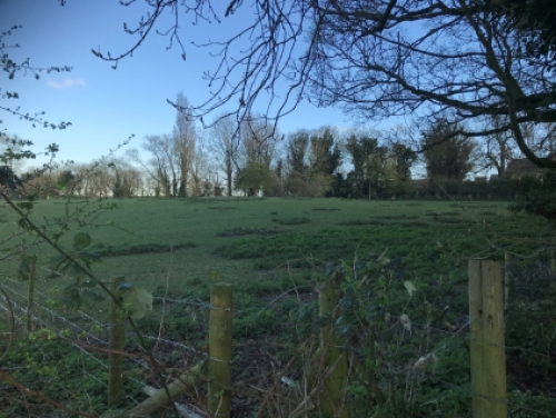
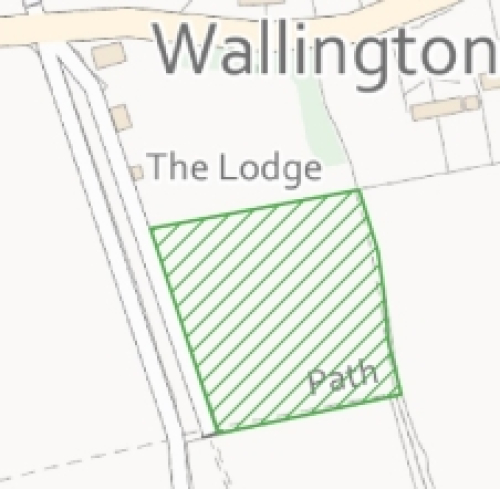
LGS2: The Chase Meadow
Address and location
Meadow located to the north of the church.
Ownership details
Privately owned.
Description and purpose / current use
Open field to the West of Mutcheaps Field, between the gardens of Wallington Chase and the Lodge.
Any designations
None.
Site allocations in Local Plan
None.
Planning permissions?
None.
Access & proximity including how close to the community it serves
Adjoining Mutcheaps Field, The Chase Meadow is located on the western edge of the village bordered by three footpaths: two within its eastern and northern borders and one just beyond its western border. As such, it provides important animal corridors and routes for walkers from the centre of the village to the Western fields.
There is also a registered footpath that runs diagonally from the entrance to the lodge through the lodge garden and across the meadow to the gate in the SW corner.
Demonstrably Special?
Wildlife: A range of birds roost and nest in the trees on the field's southern edge, including tawny owls, barn owls and red kites. Muntjac deer, badgers, foxes and bats are among the mammals that have been seen using the meadow, and common shrew and voles are present based on sightings along the adjoining footpath. There are some significant trees on the site.
Beauty/Tranquillity: An unusually tranquil site, bordered by high trees on three sides, the field offers unique views from the heart of the village towards the open fields in the West.
Local in character?
0.77 ha.
Photo
Map
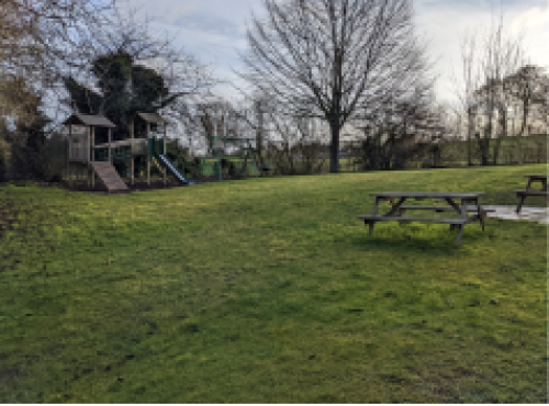
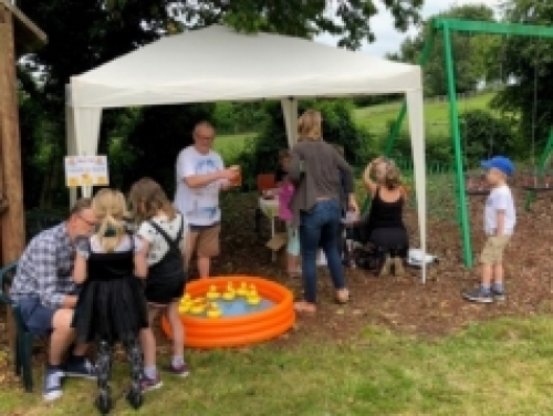
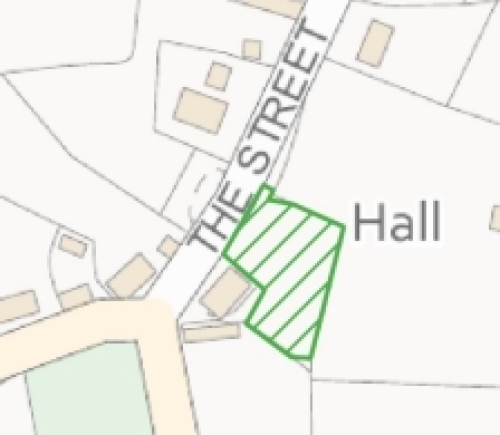
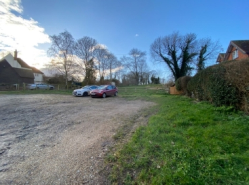
LGS3: Village Hall Playground
Address and location
Adjacent to village hall on The Street.
Ownership details
Owned by Wallington Farms.
Used by the Wallington Village Hall Committee under a Licence granted by John Wallace on 9th February 1988.
Description and purpose / current use
This is an L-shaped garden area to the north-east of the village hall. It comprises a field, which is mown and used for informal recreational activities. There is also a children's playground on the site.
Any designations
None.
Site allocations in Local Plan
None.
Planning permissions?
None.
Access & proximity including how close to the community it serves (in meters)
The village hall and its adjoining garden playground are at the centre of the village and well-used by local residents. The playground provides a much-valued area for families.
Demonstrably Special?
Recreation: The village hall and its garden are the heart of the village community. It is the site of numerous events through the year, including regular pub nights, coffee mornings, local celebrations and the village fete. The childrens' playground equipment is much utilised and was upgraded in 2019 and the garden has been particularly valuable recently as a site of outdoor meetings under Covid restrictions. The views over the adjoining Wick are much prized.
Local in character?
0.11 ha.
Photo
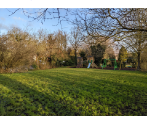
Map
---
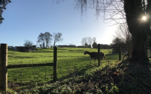
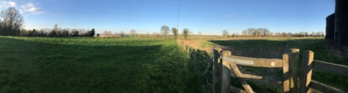
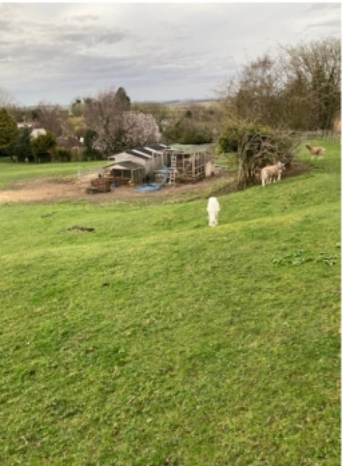
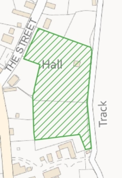
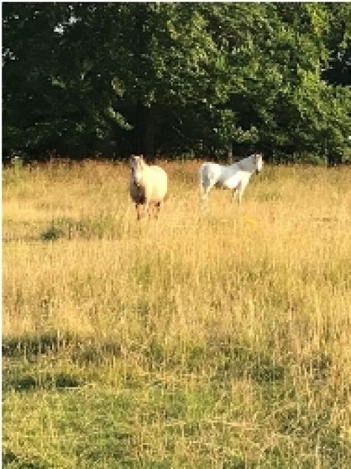
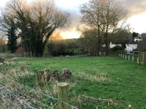
LGS4: The Wick
Address and location
The Wick lies between Manor Farmyard to the south, the Street and the houses along The Street to the west, No28 The Street and gardens to the north, and arable land to the east.
Ownership details
Wallington Farms
Description and purpose / current use
The Wick is a fenced permanent grassland area of approximately 1 ha (2.47 acres) in size that lies between Manor Farmyard to the south, the Street and the houses along The Street to the west, No28 The Street and gardens to the north, and arable land to the east. It slopes from its eastern side down towards the village so that as one goes along the Street the eye is drawn up its slope across the northern section of the meadow.
There is a hedge along its eastern boundary and part of its northern boundary and a variety of trees along the western boundary. There is a gate from the Street into the Wick and also one from Manor Farmyard.
In recent years some shelters have been erected by the grazing tenant in which to house her collection of farm animals.
Any designations
None.
Site allocations in Local Plan
None.
Planning permissions?
None.
Access & proximity including how close to the community it serves
The Wick backs on to some of the houses and the Village Hall that are situated on the eastern side of the Street and forms part of the scoop of the valley in which Wallington sits.
Demonstrably Special?
Wildlife: A great variety of wildlife has been sighted in The Wick by local residents. Mammals include field mice, bats, foxes, badgers, voles and muntjac and roe deer. Frogs and stag beetles have been recorded here. Bird sightings include: buzzards, red kite, herons, owls (barn and tawny), green woodpeckers, jackdaws, swallows, grey wagtails, fieldfare, pheasants, and kestrels.
Recreation: It is private land that is let to a village resident who keeps numerous different farm animals in the meadow. The presence of farm animals within the village bounds was reported as an important characteristic of the village by many residents in a recent village survey, and seeing the sheep, goats, chickens etc gives pleasure to some villagers.
Beauty: The slope and topography of the field is very attractive and gives a pleasant setting to that part of the village.
Tranquillity: The open space right next to the village and village hall and the sound of the farm animals in the distance adds to the rural atmosphere of Wallington.
Local in character?
This is a very small meadow but very close to the centre of the village.
Photo
Map
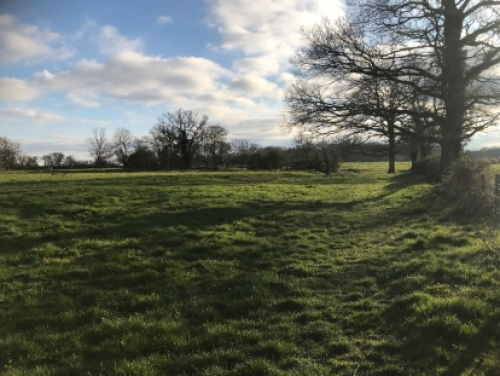
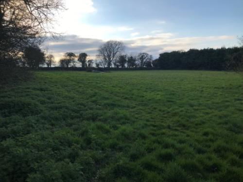
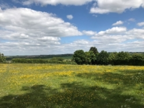
LGS5: The Park
Address and location
Located to the northwest of the village.
Ownership details
Wallington Farms Ltd. Two partners of Wallington Farms Ltd. are active participants in the Neighbourhood Plan Working Group and they support the area to be designated as a significant green space within the plan.
Description and purpose / current use
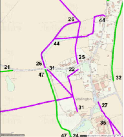
This is an area of grassland typically used for low-intensity grazing. There are well-established hedges and trees around the area, and it is crossed by several footpaths. FP 25 crosses in a north south direction, FP 44 enters at the kissing gate in the west side of the park and crosses to the east between the lines of beech trees and then exits at the north eastern corner of the field.
FP26 skirts around the outside western edge of the Park next to a copse of beech trees along the edge of the Park and further north, a hedge.
Any designations
None.
Site allocations in Local Plan
None.
Planning permissions?
None.
Access & proximity including how close to the community it serves (in meters)
The Park borders the back gardens of 8 to 17 Kits Lane and 15 to 25 The Street. It is crossed by footpaths 44 and 25.
Demonstrably Special?
Wildlife: The Park has not been cultivated for arable farming within living memory. The area is enclosed by established high hedges and mature trees on two sides, screening it from open farmland, and by garden fences and hedges on the remaining two sides. It is managed with a very light touch, used for low-intensity grazing and crops of hay. As a result, the meadow areas of The Park are carpeted with wild flowers at various times of the year and it is a haven for a wide variety of wildlife.
Notable insects include native hornets, butterflies (gatekeeper, meadow brown, marbled white), cinnabar and red burnet moths. Mammals seen include rodents – mice, shrews and voles – brown hares, rabbits, and hedgehogs are likely using it to travel between gardens (where they are frequently seen) that back onto The Park. Owls hunt over the meadow, and both tawny and barn owls have in the past nested in some of the trees. Red kites, buzzards and corvids patrol the area. Pheasants are regularly seen.
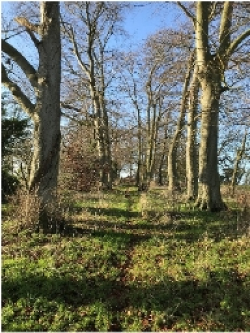
An avenue of mature beech trees crosses the centre of The Park along the line of footpath 44, and other mature trees grow within The Park itself and in its boundary hedge to the West and North West. (See historical information for more information about the project of tree-planting in Wallington).
Recreation: There are two footpaths going through The Park, and it is in regular use by walkers. FP 25 crosses in a north south orientation, FP 44 enters at the kissing gate in the west side of The Park and crosses to the east between the lines of beech trees and then exits at the north eastern corner of the field. Also, FP26 skirts around the outside western and north-western edge of The Park next to a copse of beech trees and further north, a hedge – See map below.
Beauty: The side of The Park nearest Kits Lane is recognised as an area of significant green space within the Conservation Area Character Statement, and the avenue of trees is recognised as a significant area of trees. It is an unspoiled area of traditional meadow, increasingly rare in the UK, acting as a buffer between the village and from intensively farmed arable land. The avenue of trees running across The Park is a distinctive feature, with a scale and quality rarely seen outside the grounds of stately homes.
Tranquillity: The Park is a haven of tranquillity, although extremely close to the centre of the village. It is sheltered from traffic noise and modern agricultural activity, and as such it is an exceptionally peaceful location.
Historical: The avenue of beech trees across the park is thought to have been planted in the 1960's by Rev George Robert Tuck as part of a project to screen the village from wind by enclosing the whole settlement in a double ring of trees, and possibly in memory of his son Edward John Tuck, b.1839, d. 1860.
Local in character?
The Park is an enclosed green space adjacent to the village core and is approximately 4.1 ha in size.
Photo
Map
LGS6: Plough Paddock
Address and location
To the west of The Street, opposite the Village Hall.
Ownership details
Wallington Farms
Description and purpose / current use
This is a field opposite the Village Hall. The field is often used by residents for local events.
Any designations
None.
Site allocations in Local Plan
None.
Planning permissions?
None.
Access & proximity including how close to the community it serves (in meters)
The site is close to the centre of the village, opposite the Village Hall.
Demonstrably Special?
Recreation: The field has occasionally been used for events such as the Village Fete.
Beauty: The view from the Street has been favourably commented by residents.
Historical: None known but historical map suggests that there may have been a route from the village via this area (no accredited evidence).
Local in character?
The site is fairly small in size. 0.15 ha.
Photo
Map
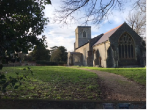
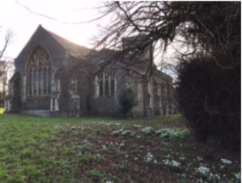
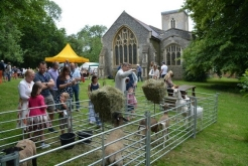
LGS7: St Mary's Wallington Churchyard
Address and location
Located in the southern part of the village.
Ownership details
Diocese of St. Albans
Description and purpose / current use
This is the churchyard surrounding St. Mary's Church Wallington.
The churchyard area in front of the church is used for the annual Village Fete, an important community and fundraising event in the village's annual calendar.
Any designations
None.
Site allocations in Local Plan
None.
Planning permissions?
None, but the Diocese or PCC would want the right to add church related facilities in future e.g. mower storage or toilets etc. This is not considered to be out of keeping with the LGS designation.
Access & proximity including how close to the community it serves (in meters)
St Mary's churchyard sits at the south west of the village and has been part of village life for centuries. The Hertfordshire Way runs past the churchyard and there are public footpaths through the churchyard too.
Demonstrably Special?
Wildlife: The church and churchyard support a variety of bird life, including spotted flycatchers, and there are also bats roosting in the church. Spotted flycatchers are summer migrants and are red listed on the UK government's list of birds of conservation concern [current list, updated Jan 2022]).
Recreation: Walkers visit the church which is kept open for visitors and there is a bench in the churchyard for visitors to use.
Beauty: The area reflects the changing seasons as it is surrounded by deciduous trees and there are snowdrops, daffodils, cowslips and wildflowers that are encouraged to thrive in the grassy area.
Tranquillity: The churchyard is an area of natural beauty and peace open to visitors all year round.
Historical: St Mary's church, built during the 14th and 15th centuries, is an important historic monument in the life of the village and is a protected building (grade II* listed). Eric Blair (George Orwell) was married in the church.
Local in character?
Yes.
Photo
Map
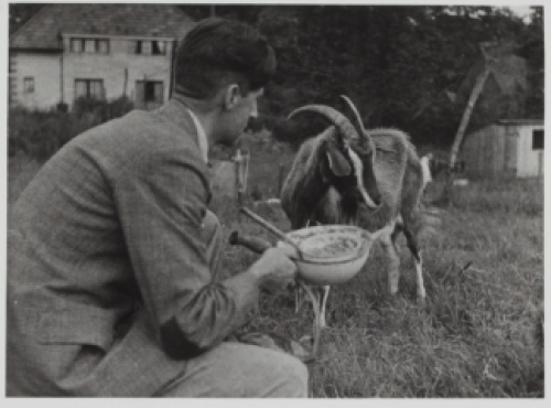
LGS8: Kitt's Piece
Address and location
Located in the centre of the village on the corner of The Street and Kit's Lane.
Ownership details
Leased by Rushden and Wallington Parish Council from North Hertfordshire District Council.
Description and purpose / current use
Kitt's Piece is a small grass and wooded area to the south side of Kits Lane and adjacent to the Kits Lane and The Street road junction. Les Arbres and No.1 Kits Lane gardens bound it to the south and west respectively. There are a variety of trees, primarily deciduous, mature with newer saplings planted to maintain and replenish the area.
Any designations
None.
Site allocations in Local Plan
None.
Planning permissions?
None.
Access & proximity including how close to the community it serves (in meters)
Kitt's Piece is at the main junction in the core of the village at the confluence of the upper and lower Street and Kits Lane. It is also the start of Postman's Path footpath which was a main pedestrian route from the lower village to the church.
Demonstrably Special?
Wildlife: Muntjac and fallow deer use the land as part of a wildlife corridor through the village. Tawny Owls are seen and heard, and the dead branches on one of the trees has provided a regular perching spot for spotted flycatchers nesting nearby. Evidence of fox and badger activity is apparent.
Recreation: The grass bank is occasionally used by walkers and other visitors
Historical: The writer George Orwell used to keep goats on the land in the 1930s.
Local in character?
Small. 0.11 ha.
Photo
Map
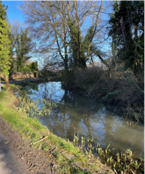
LGS9: Wallington Village Pond
Address and location
Located on the western side of The Street in the southern part of the village.
Ownership details
Rushden and Wallington Parish Council
Description and purpose / current use
This is the village pond and its surrounding area, adjacent to The Street.
Any designations
None.
Site allocations in Local Plan
None.
Planning permissions?
None.
Access & proximity including how close to the community it serves
The village pond is in the centre of the village and adjacent to the through road (The Street) that passes through the village. The Hertfordshire Way and Icknield Way pass by the Pond which is fed from the Well Pond at the top of the hill and in turn feeds the stream that runs down through the village of Wallington (and is part of the history of the village). There is also a grassy bank which is part of the area under which the stream flows through a pipe.
Demonstrably Special?
Wildlife: The pond supports a variety of bird life including nesting ducks, moorhens and grey wagtails, and also has visiting herons and spotted flycatchers. The pond attracts a variety of water creatures including frogs, sticklebacks and dragonflies.
Recreation: The pond offers a green space adjacent to the road and can be used by walkers as there is no pavement.
Beauty: The area reflects the changing seasons as it is surrounded by deciduous trees and is maintained by the local villagers.
Historical: The Village pond was an important link in the water supply that runs from the source (Well Pond at the top of the village) down The Street.
Local in character?
Yes, the pond is small in size and an integral feature of the village.
Photo
Map
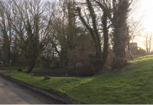
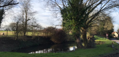
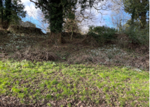
LGS10: The Well Pond and surrounding area, including the Church bankside opposite
Address and location
East of St Mary's Church.
Ownership details
Well Pond: Belongs to Wallington Village (common ownership owing to its historical functionality).
Bankside: the lane alongside the bank, which leads to the church, is maintained by Hertfordshire County Council, but ownership of the bankside is unclear.
Description and purpose / current use
The well pond area is a sheltered green space at the southeast end of the village. The area is enclosed by fencing and has a number of mature trees, a path winding through the area, wooden benches and a picnic table. The well itself was first enclosed by brickwork in Victorian times, although the spring it houses was significant to the village since first settlement, providing a reliable supply of fresh, clear water. Before the arrival of mains water, water from the spring was piped downhill to a pump by what is now the village hall.
The bankside that lies opposite the well pond area, just across the lane to the church, is a site of mature trees and wildflowers such as snowdrops and primroses. The area is adjacent to the east side of the churchyard and is noted as a significant area of trees in the Wallington Conservation Area Character Statement. The bank itself is thought enclose medieval relics of earlier settlement within.
Any designations
None.
Site allocations in Local Plan
None.
Planning permissions?
None.
Access & proximity including how close to the community it serves
The well pond and surrounding area is located within the village, lying close to the village pond and St Mary's Church.
Demonstrably Special?
Wildlife: The well pond is used during the summer months by spotted flycatchers that may be seen flitting out from their perches among the trees close to the well to catch the insects flying over the water (spotted flycatchers are summer migrants and are red listed on the government's list of birds of conservation concern [current list, updated Jan 2022]). Bats also frequent this area to catch moths and other night-flying insects during spring through autumn. In the late winter, the site is notable for its bed of yellow winter aconites and clumps of snowdrops.
Recreation: It is a tranquil place that is used for recreation and as a resting spot for walkers and cyclists passing through the village. There is a seating/picnic area within the space.
Beauty: With its stand of mature trees and wildflowers, the area is an attractive spot.
Tranquillity: The leafiness of its set-back enclosed location, together with the sound of the spring water trickling down the bank and the birdsong from the trees, create a place of tranquillity.
Historical: The location of the spring that made Wallington a site suitable for settlement: wooded and well sheltered from westerly gales, with a never-failing supply of fresh water from the spring. Some traces of historical settlement have been found in the bankside.
Local in character?
0.071 ha.
Photo
Well pond:
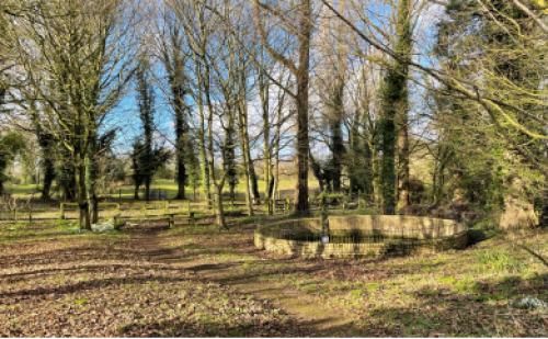
Bankside:
Map
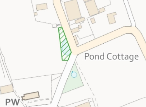
LGS11: Carter's/Parsons Pond
Address and location
South of the Church.
Ownership details
Wallington village (common ownership owing to its historical functionality)
Description and purpose / current use
Carter's pond lies opposite the main entrance gate and boundary wall of St Mary's Church, on the other side of Church Lane (see Figure 1). It is also known as Parson's pond because of its proximity to the church (see map below, Figure 2). It is a long narrow pond, typical of cart ponds built during the 18th and 19th centuries, which were designed with solid stone/brick bases to allow a horse-pulled cart to be drawn through from one end of the pond to the other. This process aided wheel tightening, cleaning and preventing wheels from shrinking or warping during prolonged dry weather. The drainage for Carters' pond is by pipe underneath the Churchyard, and the curb edging the pond is designed with three holes in the brickwork to allow water to run off Church Lane into the Pond. These holes need to be cleared regularly to stop flooding and puddling on Church Lane.
Regular pond clearing of and maintenance of drainage is organised and carried out voluntarily by village residents.
Any designations
None.
Site allocations in Local Plan
None.
Planning permissions?
None.
Access & proximity including how close to the community it serves (in meters)
Carter's pond is located within the village, lying close St Mary's Church.
Demonstrably Special?
Wildlife: Carter's Pond is used by mallard ducks and moorhens as a sheltered spot to rest and feed in. Bats also frequent the area to catch moths and other flying insects over the water, as do spotted flycatchers during the summer months. The site is characterised by its flag irises and rushes. Dragonflies and damselflies are also present.
Beauty: The display of yellow flag irises is an attractive feature.
Tranquillity: The pond contributes to the tranquil setting of St Mary's Church.
Historical: As described under 'Description' above, Carter's Pond has historical value as an important asset of the village, its presence reflecting the agricultural history of Wallington.
Local in character?
0.045 ha.
Photo
Map
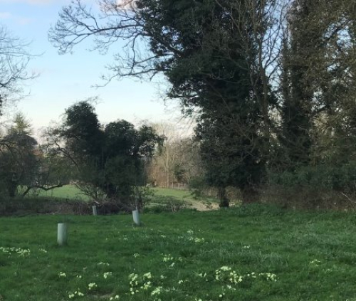
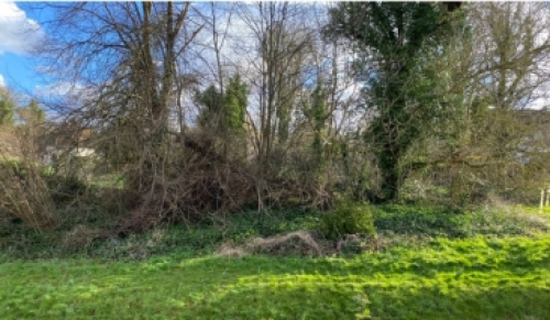
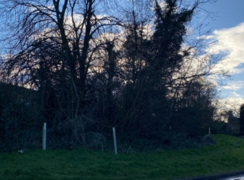
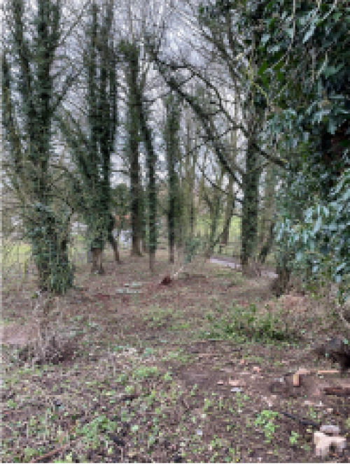
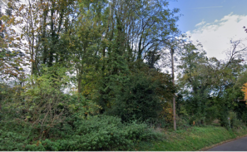
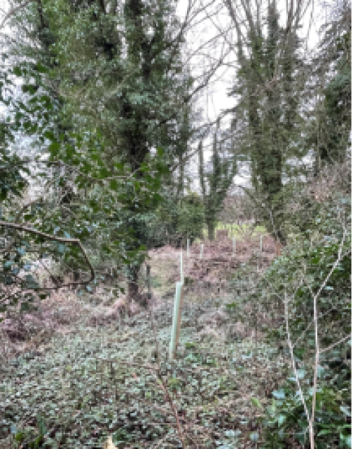
LGS12: The Spinney
Address and location
Southern side of Kit's Lane.
Ownership details
The spinney is owned by North Hertfordshire District Council. It is leased by Wallington & Rushden Parish Council.
Description and purpose / current use
The Spinney is a small patch of woodland on the south side of Kits Lane, at the start of a footpath that leads from Kits Lane to St Mary's churchyard. The Spinney is bound by the boundary fencing of the Lodge garden that runs alongside the path, Kits Lane, and the garden of number 7 Kits Lane.
The patch of woodland contains mature trees and some tree saplings planted by volunteers to help rejuvenate the spinney after several trees had to be cut down for safety reasons due to storm damage or age/disease. The new saplings are being monitored and cared for by village residents.
Any designations
None.
Site allocations in Local Plan
None.
Planning permissions?
None.
Access & proximity including how close to the community it serves (in meters)
The Spinney is located close to the village and accessed by local residents.
Demonstrably Special?
Wildlife: The spinney is frequented by tawny owls, which may nest within this patch of woodland. Deer (muntjac and fallow), foxes and wood mice and shrews have been seen in the spinney. There is evidence of badger activity, and bats are seen flying around the trees and above the footpath on summer evenings. The spinney connects with other green spaces within Wallington and thus is likely part of an important wildlife corridor. The dense undergrowth includes various "habitat piles" of fallen and cut branches. There is a carpet of native snowdrops in winter / early spring.
Recreation: The spinney has a well-used footpath running through it, which leads to the church and connects with the Hertfordshire Way and the footpaths running through Chase Meadow.
Tranquillity: The stand of native deciduous trees together with the ground vegetation lend a sense of calm and shelter.
Local in character?
Yes. 0.018 ha.
Photo
View from Kits Lane:
View from path running through the spinney, showing some of saplings that have been planted as part of ongoing maintenance of the wood. Note, photograph taken during winter:
Map
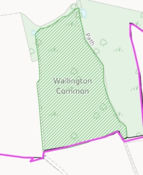
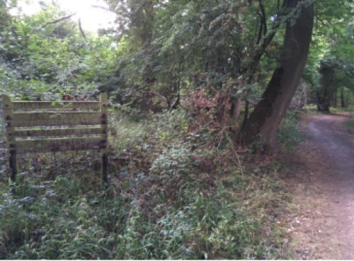
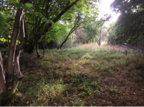
LGS13: The Common
Address and location
Wallington Common is an area of woodland 1 km south of Wallington. OS 100 km grid square TL23.
Ownership details
Owned by the Wallington Common Trust.
Description and purpose / current use
A 4.2 ha area of woodland known as Wallington Common Nature Reserve. Rights on the land are noted by common-land.com as cattle, ponies and pigs.
Estovers (6) Turbary (5) Pannage (3) Herbage (3).
Any designations
Designated as a nature reserve by Wallington Common Trust. It is a Local Wildlife Site.
Site allocations in Local Plan
None.
Planning permissions?
None.
Access & proximity including how close to the community it serves (in meters)
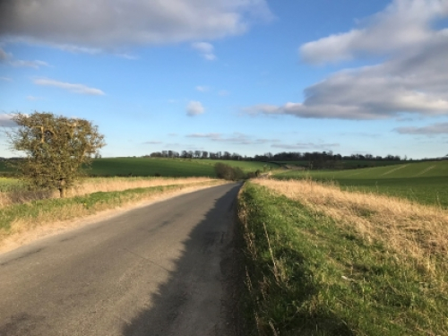
This area of woodland lies 1 km south of Wallington, between the village and Shaw Green, and is directly linked to the village by a well used bridleway and the Hertfordshire Way.
Demonstrably Special?
Wildlife: As a nature reserve, this patch of previously coppiced woodland provides undisturbed habitats featuring dense thickets and some mature trees. Sparrowhawks, thrushes, wrens, nuthatches and treecreepers have been observed, and the area is frequented by deer.
Recreation: The bridleway that runs alongside Wallington Common is a popular and well used path for walkers and horse riders.
Local in character?
Yes.
Photo
Map