Barkway and Nuthampstead Neighbourhood Plan 2018 - 2031
Ended on the 25 June 2024
(3) 3 NEIGHBOURHOOD PLAN POLICIES MAP
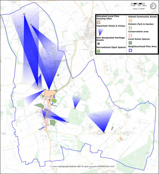
The map below shows the entire Neighbourhood Plan area with each policy depicted on the map and in the key.
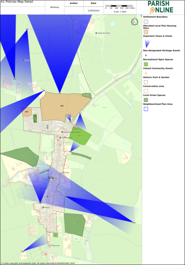
It is not possible to clearly see the detail within Barkway village on an A4 page. An A1 PDF version of the Policies Map can be viewed on the Neighbourhood Plan page of Barkway Parish Council website.
The details of Barkway village are shown in Figure 5: Policies Map Detail of Barkway village. Largescale maps of Local Green Spaces, Non-designated Heritage Assets and Important Views can be found in the relevant Appendices.

Figure 4: Barkway Neighbourhood Plan Policies Map

Figure 5: Policies Map Detail of Barkway village
For instructions on how to use the system and make comments, please see our help guide.
